
Thumbnail
Map Links
Metadata
Abstract
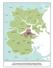
Map showing the Central Area and the Boston Business District with surrounding towns and Boston neighborhoods
Data type
static map
Last updated
Source
Town boundaries: MassGIS data layer; Boston Business District boundaries: CTPS delineation for LRTP Needs Assessment
Projection and coordinate system
NAD_1983_StatePlane_Massachusetts_Mainland_FIPS_2001_Meters
Use constraint
available for download
Contact name
CTPS Certification Activities Group
Disclaimer
This data is intended for informational purposes only. CTPS provides this information on an "as is" basis and makes no guarantee, representation or warranty, either express or implied, that the data will be error free. CTPS further makes no guarantees, representations or warranties, either express or implied, as to the completeness, accuracy or correctness of the data, or as to merchantability or fitness of the data for a particular use or purpose. CTPS is not responsible to any user for any costs, expenses, liabilities or damages arising from inconsistencies in its data or from any use of the information.