TECHNICAL MEMORANDUM
DATE: February 10, 2026
TO: Allison Luff, PE, City of Quincy
FROM: Kyle Casiglio, AICP, Boston Region MPO
Tanner Bonner, Boston Region MPO
RE: Community Transportation Technical Assistance (CTTA) Program: Quincy Bluebikes Station Location and Prioritization
This memorandum describes the results of a transportation study of potential locations to site Bluebikes bikeshare stations in the City of Quincy, Massachusetts. The study was conducted through the Boston Region Metropolitan Planning Organization’s (MPO) Community Transportation Technical Assistance (CTTA) Program, through which MPO staff provide technical analysis and support to municipalities in the Boston metropolitan area about local multimodal transportation issues.
The City of Quincy contacted staff at the MPO regarding the potential of Quincy joining the consortium of municipalities that comprise the Bluebikes bikeshare system. One of the vital steps to joining the system is to develop a prioritized list of station locations, which City of Quincy staff requested the MPO’s assistance in developing.
MPO staff reviewed public outreach conducted by City of Quincy and Massachusetts Department of Transportation (MassDOT) staff for other transportation projects and consulted a variety of data sources to develop a scoring methodology to be applied at the census block level. Once the census blocks were scored and prioritized, MPO staff worked with City of Quincy officials and other local stakeholders to identify specific locations within these block groups that have a high potential for supporting a bikeshare station.
This memorandum describes the development of that methodology, the process of selecting site locations, the next steps the City of Quincy can take to advance bikeshare within the municipality, and potential funding sources for bikeshare stations.
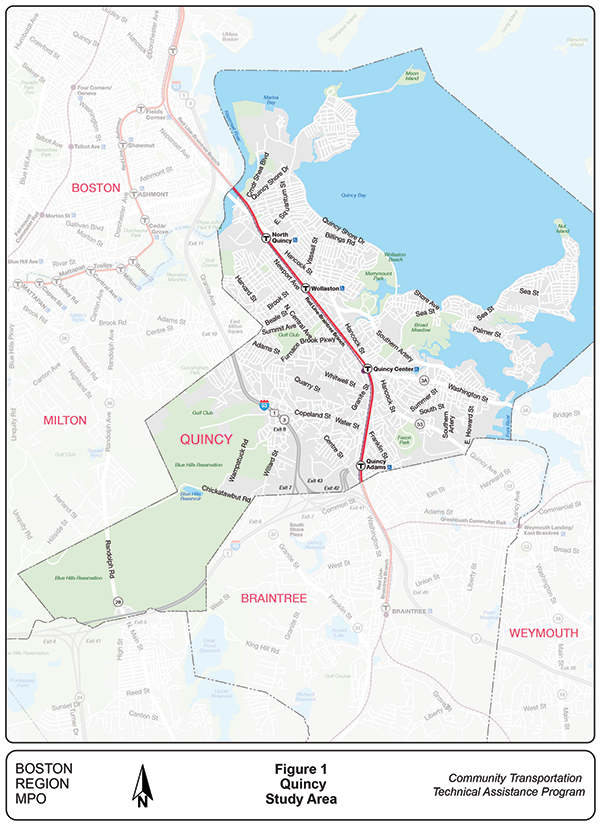
The City of Quincy is an urban municipality and the largest by population, 101,636 as of the 2020 decennial census, in Norfolk County. It shares a border with Boston to its north, Milton to its west, Randolph and Braintree to its south, and Weymouth to its southeast. Its location within the MPO region is illustrated in Figure 1 on the next page.
Quincy has seen steady population growth since 2000, growing by approximately 13,500 people between then and 2020. Its demographic characteristics have become increasingly diverse over that time period, and the city is home to a large Asian-American-Pacific-Islander (AAPI) population, growing from approximately 15 percent of the population in 2000 to more than 30 percent in 2020. According to American Community Survey estimates, more than 90 percent of households in Quincy have access to a motor vehicle. However, a plurality of households only have one vehicle. Renters make up a small majority of residents, approximately 55 percent of all households. Household median income, at $95,711, is slightly below the state’s median household income of $101,341.
Quincy’s built environment is shaped by its diverse geographic features that range from the Blue Hills to its long coastline and peninsular neighborhoods, its history as a hub for granite mining and coastal industry, and its proximity to Boston that positions it as a modern commuter hub. The city has a “spine” running northwest-southeast that follows Hancock Street and the railroad tracks that provide both regional rail service north to Boston and south to the MBTA’s old colony branch lines, and rapid transit service on the MBTA’s Red Line between Braintree and Alewife Station in Cambridge. Along this spine are the primary commercial and multifamily housing clusters of Quincy. Outside of this corridor is a mix of single-family and multifamily neighborhoods based around former industrial hubs such as Quincy Point, Marina Bay, and West Quincy, peninsula neighborhoods, such as Squantum, Hough’s Neck, and Germantown, and Qunicy’s office parks at Crown Colony and North Quincy.
The city does not currently have extensive facilities for people using bicycles. The existing infrastructure includes conventional bike lanes, many of which are adjacent to on-street parking in a position that leaves people biking vulnerable to car doors. Scattered segments contain lanes that are buffered with paint. No protected facilities currently exist or are planned within the city. Concurrent with the process of the study, the City of Quincy engaged in a Multimodal Master Plan planning effort that may result in changes in the planned bike network. MassDOT was engaged in a planning process regarding a large segment of MA-3A within the city, which encompassed the segment between the Quincy-Boston border and Merrymount Road, concurrent with the study period.
Bikeshare has existed in Quincy in the past, operated through private companies such as Lime and Ofo. Both of these systems, unlike Bluebikes, operated in a dockless model that did not require users to check-out/in bikes at particular locations. While municipalities are able to exercise a degree of regulatory control over such systems, participating in the regional network allows for a greater range of accessible locations for users and would give the City of Quincy more direct control over where and how bikes are deployed.
MPO staff devised a model to identify a group of census blocks that have desirable characteristics for bikeshare placement and meet particular requirements as a whole. Census blocks were chosen as the spatial unit in the analysis scoping phase to enable a balance of both specificity and flexibility in siting. The model incorporated a set of inputs from readily available datasets that were informed by previous MPO research on station siting best practices and were chosen collaboratively with Quincy staff. As a first step, census blocks were individually assigned a suitability score from a weighted sum of input metrics, listed in Table 1 below.
Table 1
Census Block Suitability Input Metrics
Alongside individual census block suitability scores, requirements were established to ensure that the model would identify a group of locations that enables transit connectivity, maintains a balance of spread and density, connects to the existing Bluebikes network, and is equitably distributed. These requirements are further detailed in Table 2 below.
Table 2
Census Block Suitability Input Metrics
| Characteristic |
Requirement |
Data Source |
|---|---|---|
Proximity to rapid transit |
Approximately half of the proposed census blocks should be near rapid transit stations. |
MBTA GTFS (2023) |
Proximity to existing Bluebikes network |
At least one proposed census block should be within ½ mile of an existing Bluebikes station. |
Bluebikes System Data (2025) |
Network density (maximum distance) |
Proposed census blocks should be at least within ½ mile of another proposed census block. |
Not applicable |
Network spread (minimum distance) |
Proposed census blocks should be at least ¼ mile away from another proposed census block. |
Not applicable |
Equitable distribution |
The percent minority and low-income populations of proposed census blocks as a whole should be at least as much as the Quincy population overall. |
2020 Decennial Census, 2019-2023 American Community Survey (ACS) 5-Year Estimates |
GTFS = General Transit Feed Specification.
A series of processing steps were incorporated to ensure the model output a set of census blocks that both scored relatively high and met requirements as a group. To promote transit connectivity, census blocks were evaluated as part of two distinct groups: census blocks near rapid transit stations, and census blocks outside of a half-mile buffer of rapid transit stations. MPO staff chose to identify two blocks per rapid transit station in Quincy, each from a distinct census block group which scored the highest within that census block group. This approach was taken to ensure connectivity along all MBTA Red Line stations while allowing for some spread. While the emphasis of this study was to develop a bikeshare network that would support connections to and from rapid transit, the methodology was designed to be replicated across the region while remaining flexible to local community context.
Census blocks outside of a half-mile mile buffer of rapid transit stations were chosen primarily via a greedy optimization algorithm that iteratively selected top scoring census blocks that were within ideal distance of each other. Upon investigation of initial outputs, some requirements were relaxed to enable a balanced high-scoring output, including the following:
MPO staff identified 20 priority census blocks for Bluebikes station locations. The 20 priority blocks received a relatively high suitability score and generally met the requirements detailed in the Methodology Development. Of the 20 priority blocks, 8 are near a rapid transit station while 12 are at least a half mile away from a rapid transit station. The blocks are shown in Figure 2 on the following page. These blocks cover many but not all neighborhoods in Quincy and can serve as a starting point for a more comprehensive network in the future.
Figure 2
Priority Census Blocks
Bonner, Tanner, “Bluebikes and MBTA Connections,” Boston Region Metropolitan Planning Organization (2025). https://www.ctps.org/study/bluebikes-mbta-connections
The roadway network was obtained via OpenStreetMap. For more information on OpenStreetMap, see https://www.openstreetmap.org/.
See https://reimbar.org/posts/jain-fairness/ for more detail on Jain's fairness index.