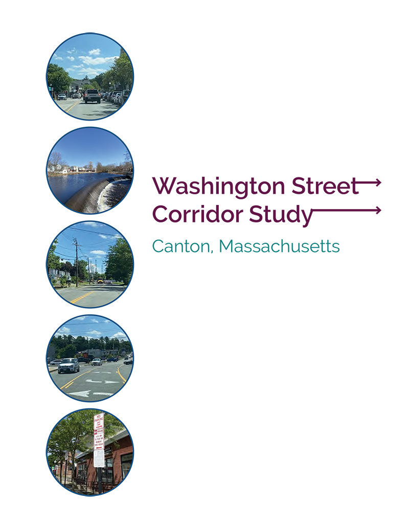
Washington Street Corridor Study in Canton
Project Manager
Chen-Yuan Wang
Julie Dombroski
Project Principal
Mark Abbott
Data Analysts
Chen-Yuan Wang
Julie Dombroski
Kathy Jacob
Graphics
Kenneth Dumas
Kim DeLauri
Adriana Fratini
Cover Design
Kim DeLauri
Editor
David Davenport
The preparation of this document was supported
by Federal Highway Administration through
MPO Combined PL and 5303 #114674 and
MPO Combined PL and 5303 #118967.
Central Transportation Planning Staff is
directed by the Boston Region Metropolitan
Planning Organization (MPO). The MPO is composed of
state and regional agencies and authorities, and
local governments.

The Boston Region Metropolitan Planning Organization (MPO) operates its programs, services, and activities in compliance with federal nondiscrimination laws including Title VI of the Civil Rights Act of 1964 (Title VI), the Civil Rights Restoration Act of 1987, and related statutes and regulations. Title VI prohibits discrimination in federally assisted programs and requires that no person in the United States of America shall, on the grounds of race, color, or national origin (including limited English proficiency), be excluded from participation in, denied the benefits of, or be otherwise subjected to discrimination under any program or activity that receives federal assistance. Related federal nondiscrimination laws administered by the Federal Highway Administration, Federal Transit Administration, or both, prohibit discrimination on the basis of age, sex, and disability. The Boston Region MPO considers these protected populations in its Title VI Programs, consistent with federal interpretation and administration. In addition, the Boston Region MPO provides meaningful access to its programs, services, and activities to individuals with limited English proficiency, in compliance with U.S. Department of Transportation policy and guidance on federal Executive Order 13166. The Boston Region MPO also complies with the Massachusetts Public Accommodation Law, M.G.L. c 272 sections 92a, 98, 98a, which prohibits making any distinction, discrimination, or restriction in admission to, or treatment in a place of public accommodation based on race, color, religious creed, national origin, sex, sexual orientation, disability, or ancestry. Likewise, the Boston Region MPO complies with the Governor's Executive Order 526, section 4, which requires that all programs, activities, and services provided, performed, licensed, chartered, funded, regulated, or contracted for by the state shall be conducted without unlawful discrimination based on race, color, age, gender, ethnicity, sexual orientation, gender identity or expression, religion, creed, ancestry, national origin, disability, veteran's status (including Vietnam-era veterans), or background. A complaint form and additional information can be obtained by contacting the MPO or at http://www.bostonmpo.org/mpo_non_discrimination. To request this information in a different language or in an accessible format, please contact Title VI Specialist By Telephone: For people with hearing or speaking difficulties, connect through the state MassRelay service:
For more information, including numbers for Spanish speakers, visit https://www.mass.gov/massrelay
|
Abstract
The Washington Street Corridor Study in Canton is one in a series of studies supported by the Boston Region Metropolitan Planning Organization that address safety, mobility, and access on the Boston region’s roadways. This report identifies specific transportation issues and concerns in the Washington Street Corridor and a major commercial district at Cobb Corner adjacent to the corridor; presents an in-depth analysis of multiple transportation-related factors, such as accommodations for people who walk and bike and safe access to adjacent businesses; proposes short- and long-term improvements to address the problems; and provides a vision for the corridor’s long-term development.
1.4...... Study Area and Data Collection
1.5...... Study Advisory Committee Meetings
Chapter 2— Existing Conditions and Issues
2.2...... Corridor User Survey
2.2.1 Survey Questions and Answers
2.2.2 Summary of Survey Results
Traffic Circulations and Operations
Business Access/Parking Issues
Pedestrian Accommodation and Safety
Bicycle Accommodation and Safety
Emergency Responses and Operations
Land Use and Other Transportation Related Issues
3.1...... Corridor Crash Statistics
3.2...... Corridor and Intersection Crash Rates
3.3...... Analysis of Collision Diagrams
Washington Street between Neponset Street and High Street (Figure F-3 and Table F-3 in Appendix F)
Washington Street in the Vicinity of Cobb Corner (Figure F-5 and Table F-5 in Appendix F)
Washington Street/Bay Road at Route 27 (Figure F-6 and Table F-6 in Appendix F)
Chapter 4—Roadway Operations Analysis
4.1...... Daily Traffic Volumes
4.2...... Intersection Turning Movement Counts
4.3...... Pedestrian and Bicycle Volumes
4.4...... Heavy Vehicle Volumes
4.5...... Intersection Capacity Analyses
4.6...... Roadway Travel Speeds
4.7...... Existing Roadway Layouts and Proposed improvements and Reconfigurations
Canton Center Section (Washington Street from Sherman Street to Walnut Street)
Residential Section (Washington Street between Walnut Street and Village Shoppes Driveway)
Cobb Corner Commercial Section (Washington Street from Village Shoppes Driveway to Route 27)
Chapter 5—Proposed Improvements
5.1...... Corridor Improvement Objectives and Design Strategies
5.2...... Canton Center Section
5.2.2 Proposed Short-Term Improvements
5.2.3 Proposed Long-Term Improvements
5.3.2 Proposed Short-Term Improvements
5.2.3 Proposed Long-Term Improvements
5.4...... Cobb Corner Commercial District
5.4.2 Proposed Short-Term Improvements
5.4.3 Proposed Long-Term Improvements
5.5...... Overview of Proposed Long-Term Improvements Under Projected 2030 Traffic Conditions
Chapter 6—Summary and Recommendations
Figure 2 Transit Services in the Area
Figure 3 Corridor User Survey Questions and Results: Questions 1 to 4, Part 1
Figure 4 Corridor User Survey Questions and Results: Questions 5 to 7, Part 2
Figure 5 Average Weekday Traffic Volumes
Figure 6 Estimated 2021 Weekday AM/PM Peak-Hour Intersection Traffic and Pedestrian Volumes, Part 1
Figure 7 Estimated 2021 Weekday AM/PM Peak-Hour Intersection Traffic and Pedestrian Volumes, Part 2
Figure 8 Estimated 2021 Saturday Peak-Hour Intersection Traffic and Pedestrian Volumes, Part 1
Figure 9 Estimated 2021 Saturday Peak-Hour Intersection Traffic and Pedestrian Volumes, Part 2
Figure 14 Speed Regulations and Estimated 85th Percentile Speeds
Figure 15 Existing Roadway Cross Section and Proposed Improvements: Canton Center Section
Figure 16 Existing Roadway Cross Section and Proposed Reconfigurations: Residential Section
Figure 18 Proposed Improvements Conceptual Plan: Canton Center Section, Part 1
Figure 19 Proposed Improvements Conceptual Plan: Canton Center Section, Part 2.
Figure 20 Proposed Improvements Conceptual Plan: Residential Section
Figure 21 Proposed Improvements Conceptual Plan: Cobb Corner Commercial District
Figure 24 2030 Saturday Peak-Hour Intersection Capacity Analyses with Proposed Improvements, Part 1
Figure 25 2030 Saturday Peak-Hour Intersection Capacity Analyses with Proposed Improvements, Part 2
Appendix A: Study Advisory Members
Appendix B: Summary of Corridor User Survey Results and Comments
Appendix C: Corridor Crash Data (2015–19) Summary
Appendix D: Corridor Crash Rate Worksheets
Appendix E: Intersection Crash Rate Worksheets
Appendix F: Collision Diagrams and Crash Look-Up Tables
Appendix G: Automatic Traffic Recorder Counts, November 29–December 5, 2021
Appendix H: Turning Movement Counts, December 1 and 4, 2021 and July 14 and 16, 2022
Appendix I: Intersection Capacity Analyses: Weekday AM Peak Hour, 2021 Estimated Traffic Condition
Appendix J: Intersection Capacity Analyses: Weekday PM Peak Hour, 2021 Estimated Traffic Condition
Appendix K: Intersection Capacity Analyses: Saturday Peak Hour, 2021 Estimated Traffic Condition
Appendix L: Speed Data from Automatic Traffic Recorder Counts, November 29–December 5, 2021
Appendix N: Preliminary Traffic Signal Needs Analysis: Washington Street at High Street
Appendix R: MassDOT Project Development Process
Each year, the Boston Region Metropolitan Planning Organization (MPO) conducts outreach to local agencies, municipalities, the public, and other stakeholders during the development of the Unified Planning Work Program, a program of studies and research projects that provide transportation planning and technical assistance to municipalities and agencies in the Boston region. The purpose of this outreach is to gather information about specific transportation problems in the region so that studies may be conducted to analyze these issues, and projects may be developed to address these issues to improve the operation of the transportation system.
The MPO’s series of Subregional Priority Roadways studies grew out of this information-gathering process. These studies identify safety, mobility, access, and other transportation-related concerns on specific roadways identified as requiring improvements by subregional planning groups. The studies evaluate potential multimodal solutions to the problems and then make recommendations for agencies and municipalities to implement. Each year, the Boston Region MPO chooses an arterial or collector roadway for staff to analyze, which results in recommendations of short- and long-term improvements for that roadway area.
Selecting a study area in the Boston region is a thorough and exacting process, based on many factors. In any large metropolitan region, there are many roadways that need improvement, so it can be a challenge to single out just one. However, because the MPO’s Subregional Priority Roadways program is ongoing, MPO staff can address each problem area methodically, according to priority and regional needs.
This report focuses on the Washington Street corridor from Sherman Street to Cobb Corner (the junction of Washington Street and Route 27) in Canton, Massachusetts. It contains a review of existing conditions, various safety and operations analyses, and proposed short- and long-term improvements to address the problems in the study area that contains a Canton Center section and a residential section in the corridor and a major commercial district at Cobb Corner adjacent to the corridor.
Key issues and concerns identified for the corridor include the following:
The proposed short-term improvements could enhance safety and improve traffic operations. They have a high benefit-to-cost ratio and should be planned, designed, and implemented as soon as resources are available, especially those recommended for the Canton Center section. Long-term improvements requiring major roadway reconfigurations are considered not applicable under the surrounding well-developed conditions in this section of the corridor
For the residential section and the Cobb Corner commercial district, it would require a series of long-term improvements to significantly improve the safety, mobility, and access for all users. The study proposes the following major improvements:
These proposed long-term improvements would have the following expected benefits:
Together, the proposed improvements in this study provide a vision for the long-term development of the corridor and the adjacent commercial district. Achieving the proposed Complete Streets vision for the corridor and the adjacent commercial district via the recommended improvements would require sufficient resources and significant effort and collaboration on the part of all stakeholders, including the three towns of Canton, Sharon, and Stoughton, residents, property and business owners, Brockton Area Transit Authority, Massachusetts Bay Transportation Authority, and Massachusetts Department of Transportation Highway Division Districts 5 and 6.
Chapter 1—Introduction
During development of the Unified Planning Work Program (UPWP) and the Long-Range Transportation Plan (LRTP), the Boston Region Metropolitan Planning Organization (MPO) gathers feedback from the public, municipalities, the Metropolitan Area Planning Council’s subregional groups, and the Massachusetts Department of Transportation (MassDOT) to identify transportation problems in the region. These problems generally involve accommodations for people who walk, bike, and use mobility devices; freight movement; traffic bottlenecks; safety of roadway users; and safe or convenient access for abutters along roadway corridors—problems that can adversely affect the region’s quality of life, economic development, and air quality.
Each year, the MPO conducts a study, Addressing Safety, Mobility, and Access on Subregional Priority Roadways, to identify roadway segments in the Boston region that are of concern to stakeholders, but that have not been cited in the regional needs assessment conducted for the LRTP. 1 The Subregional Priority Roadways studies focus on arterial or collector roadways and result in recommendations for short- and long-term improvements. Funding for the Washington Street Corridor Study in Canton was documented in the federal fiscal year (FFY) 2022 UPWP, and a work program outlining the study was endorsed by the MPO board on August 19, 2021.
The Washington Street Corridor Study in Canton focused on safety, mobility and access, and specific concerns related to bicycle and pedestrian transportation, multiuse trail feasibility, and other subjects raised by stakeholders. The objectives of the study were to
The MPO selected the Washington Street corridor in Canton by assessing 20 roadway corridors in the Boston region that were identified as potential candidates for study by various sources, including (1) suggestions heard during outreach for the FFY 2022 UPWP; (2) concerns documented in meeting records from the UPWP outreach process since 2013; and (3) data from the MPO’s Congestion Management Process. MPO staff assembled detailed data about these roadways and evaluated them according to the following selection criteria:
Washington Street is a major north-south corridor that serves regional traffic and goes through the central part of Canton. It is a two-lane roadway classified as an Urban Principal Arterial and is under the jurisdiction of Canton. The selected study corridor is about 1.6 miles of Washington Street from Sherman Street to Route 27. It contains a Canton Center section, a residential section, and a major commercial section near Cobb Corner (Washington Street at Route 27).
The Town of Canton recently completed a town master plan, which identified these two areas in the corridor as priorities for implementation. The section in between the two areas is a densely settled residential district that contains single-family houses, multifamily buildings, and affordable housing units, including Canton Housing Authority units for seniors. Improving the accommodation and safety for people who walk and use a mobility device would significantly benefit the seniors and people with disabilities. Meanwhile, improving the accommodation and safety for people who bike on Washington Street is one of the high priorities in the town master plan.
In addition to the selected Washington Street corridor, the study area includes the intersection of Washington Street at Route 27 and a section of Route 27 (Sharon Street) adjacent to the Cobb Corner commercial district and cross and side street from the corridor. Major cross streets in the corridor include Sherman Street, Neponset Street, High Street, and Route 27 (Sharon Street in Stoughton/North Main Street in Sharon). Figure 1 shows the study corridor, adjacent roadways, and major developments in the study area.
At the request of MPO staff, MassDOT collected daily traffic volumes and intersection turning movement counts (including pedestrian and bicycle movements and the percentage of heavy vehicles) for this study from November 29 to December 5, 2021, a period during the COVID-19 pandemic when traffic was still less intensive than the usual conditions. Staff reviewed historical counts and MassDOT COVID-19 traffic monitoring reports and made a series of adjustments to the collected data, so that the data would reflect the normal traffic conditions to be used for a series of essential analyses in this study.
MPO staff also collected a series of data from the Town of Canton, including land use and zoning information, traffic studies from recent proposed developments and redevelopments in the corridor, and the police crash reports for a five-year period from 2015 to 2019.
MPO staff developed a corridor user survey to gather feedback from the public on perceived and actual problems with the corridor and to solicit improvement ideas. The survey yielded helpful information in identifying the issues and concerns and in developing improvement strategies for the corridor.
During the study, MPO staff worked closely with an advisory committee comprised of representatives from Canton, Sharon, Stoughton, Old Colony Planning Council, Brockton Area Transit Authority, MassDOT Office of Transportation Planning, and MassDOT Highway Division District 6. Appendix A contains a complete list of the study advisory members.
Two advisory committee meetings were held to support and guide the study. In the first meeting (March 9, 2022), MPO staff introduced the study, received input about the corridor’s issues and concerns, and coordinated data collection needs. In the second meeting (September 14, 2022), staff presented the analyses and findings and discussed the proposed short- and long-term improvement alternatives with the advisory committee members. After the meetings, staff received comments and revised the proposed improvements accordingly.
1 Roadways prioritized for improvement through this needs assessment are addressed through another annual work program, Addressing Priority Corridors from the Long-Range Transportation Plan Needs Assessment.
2 Details of the criteria and rating system may be found in the Central Transportation Planning Staff’s technical memorandum, “Selection of FFY 2022 Subregional Priority Roadway Study Location,” dated January 20, 2022.
Chapter 2— Existing Conditions and Issues
Washington Street can be regarded as the most important arterial roadway for the town. It runs through the central area of Canton from Route 27 in the south near the town border with Sharon and Stoughton to Route 138 (Turnpike Street) in the north near Interstate 93 (I-93) and the Town of Milton. Washington Street can also be regarded as the “Main Street” of Canton, as its central section serves Canton Center, an economic and cultural district that is popular with residents of the town and adjacent communities. Due to its connections to Interstate 95 (via Route 27 and Neponset Street) and I-93 (via Route 138), it also carries a high proportion of through-town regional traffic.
The study corridor is about 1.6 miles of Washington Street from Sherman Street to Route 27, including the intersections at both ends (Figure 1). It is a two-lane roadway, one lane in each direction, which carries approximately 14,000 to 21,000 vehicles per weekday. The entire corridor is classified as Urban Principal Arterial and is under the jurisdiction of the Town of Canton, except the intersection of Washington Street at Route 27 which is under the jurisdiction of the Town of Sharon.
Based on the adjacent land uses and the existing roadway layouts, the corridor can be divided into three sections:
The first section is located within the Canton Center Economic Opportunity District. 3 It is a vibrant district that contains various types of land uses, including municipal institutions and offices (Town Hall, Town Library, and Canton Housing Authority), US Postal Service, transportation services (Canton Center commuter rail station and Shell gas station), senior housing, religious institutions (St. Oscar Romero Catholic Church and St. John’s School), banks and financial services, health care services, Walgreen Pharmacy, convenience stores (Canton Market and 7-Eleven), local stores and businesses, and many popular restaurants and cafes. It is also a district with rich heritage. A small municipal park near Forge Pond is dedicated to celebrating the historical sites in this area, such as Kinsley Iron & Machine Company, Revere Copper Company, and Paul Revere’s residence in 1801.
To support the various economic and cultural activities, on-street and off-street parking spaces are provided throughout the district. A recent parking study conducted for the district found that the on-street parking spaces (existing on both sides of Washington Street) were fairly well used and the off-street parking lots (most located just behind the stores and accessible from side streets near Washington Street) were underused probably due to insufficient information. 4
This section contains five signalized intersections at Sherman Street, Revere Street, Bolivar Street, Church Street, and Neponset Street, and many side streets and driveways from adjacent commercial and residential developments. Church Street and Neponset Street are under one signal controller. Sherman Street excepted, traffic signals at these intersections are coordinated with the Church Street/Neponset Street intersection as the master intersection. 5
All the signalized intersections contain crosswalks for people to cross Washington Street and pedestrian signals with exclusive signal phases. In addition, five crosswalks with no traffic controls exist in the section at Centre Street, the entrance of Canton Center commuter rail station, St. Oscar Romero Church, Mechanic Street, and Walnut Street.
Sidewalks exist on both sides of Washington Street. With landscaping and street furniture, they are pleasant and generally sufficient for two-way pedestrian traffic, except for the section between Bolivar Street and Neponset Street that appears to be somewhat narrow. No dedicated bike lanes exist in this roadway section. Bicyclists (mostly youths) frequently ride or walk their bikes on sidewalks.
With intensive traffic, on-street parking maneuvers, and pedestrian crossing activities, this downtown section is usually congested during peak hours, especially in the busy section of Washington Street between Bolivar Street and Neponset Street. In particular, the short section between Church Street and Neponset Street can be regarded as a key bottleneck location in the corridor due to its high traffic volume operated under limited travel lanes. 6
The second section, Washington Street between Walnut Street and the driveway of Village Shoppes Shopping Mall, contains residential districts. Its adjacent areas are thickly settled with single-family houses and several apartments and condos on Washington Street or adjacent side streets. The travel lanes in this section are wide and vehicles frequently travel at speeds much higher than the posted speed limits. There are no dedicated bike lanes, and the shoulders generally are narrow with a width of about two to three feet.
The intersection of Washington Street at High Street is the major intersection in this section. It is unsignalized and the stop-controlled High Street approach is usually congested during peak hours, as it carries crosstown traffic (from Route 27 and I-95) in addition to the neighborhood traffic. The intersection has crosswalks on Washington Street northbound and on High Street. The crosswalks are equipped with Rectangular Rapid Flashing Beacons (RRFB). However, they are not easily observable due to the intersection’s large layout.
Another crosswalk on Washington Street, also equipped with RRFBs, is at Hagan Court. It is near a curve section south of Pond Street, with no advance pedestrian crossing warning signage. Sidewalks exist on both sides in most sections and no sidewalks exist on the southbound side south of Pond Street.
The third section, Washington Street from Village Shoppes Driveway to Route 27, contains large commercial areas on both sides. The east side has a large area that hosts a major shopping mall (Village Shoppes), a shopping plaza (Cobb Corner Plaza), CVS, McDonald’s, Starbucks, and several popular restaurants, with plenty of parking spaces. The area on the west side is smaller and contains two traditional shopping plazas that house stores, shops, and pizzerias, with sufficient parking spaces.
Washington Street in this commercial section consists of three travel lanes, one for northbound, one for southbound, and a two-way left-turn lane (TWLTL) in the middle. The TWLTL may not be suitable in this section with multiple driveways, as it creates numerous conflicting points on Washington Street (see Section 3.3 for the collision analysis for this roadway section). No sidewalks exist on the southbound side and a short section on the northbound side between Route 27 and the driveway of Cobb Corner Plaza is missing.
A midblock crosswalk exists just north of the plaza driveway near the McDonald’s. It is not signalized and does not have advance crossing warning signage. No dedicated bike lanes exist in this section, and shoulders are narrow with a width of about two feet.
The key intersection in this section is at Route 27 (Sharon Street/North Main Street). It is signalized and has a large layout with double travel lanes on all approaches. Crosswalks are provided on all approaches with push buttons for an exclusive pedestrian signal phase. Traffic is usually congested during peak hours at this intersection, as it carries significant regional traffic with various trip purposes in addition to the area’s shopping traffic. Left-turn demands are high on all approaches (especially on the southbound and eastbound), but no dedicated left-turn lanes are provided. Meanwhile, the signal system appears to be outdated.
In addition to this Washington Street section, a section of Sharon Street extending east from Cobb Corner for about 750 feet is highly related to the transportation operations in this commercial area. This study thus includes the Sharon Street section for analysis and exploration of potential improvements. When referring to the entire commercial area adjacent to Cobb Corner, this report names it as Cobb Corner Commercial District, such as Section 5.4 in Chapter 5 Proposed Improvements.
Transit services in the corridor and the adjacent areas include two Massachusetts Bay Transportation Authority (MBTA) commuter rail lines, MBTA Bus Route 716, and Brockton Area Transit Authority (BAT) Route 14. Figure 2 shows the locations of these routes in the study area.
The MBTA commuter rail Providence Line runs between Wickford Junction or Providence in Rhode Island and South Station in Boston, with a station at Canton Junction. The MBTA Commuter Rail Stoughton Line runs between Stoughton and South Station, with a station at Canton Center. Both lines join at Canton Junction and use the same track all the way to Boston, serving several communities. Sufficient parking is provided at both stations. The Canton Center Station is in the study corridor and the Canton Junction is just about half a mile from Canton Center and accessible from Sherman Street. 7
The MBTA bus Route 716 runs between Cobb Corner and Mattapan Station in Milton, via Washington Street and Turnpike Street in Canton and Washington Street and Blue Hill Avenue in Milton. It provides eight inbound and nine outbound trips per weekday and nine inbound and nine outbound trips on Saturdays. The headway between the trips is about one and half hours. There are no specific stops. Buses stop at any safe location along the route. To board the buses, riders must signal the driver at a safe roadside location. If they change their usual boarding spot, they can call A&A Metro, the current service provider.
BAT Route 14 runs between Cobb Corner and BAT Center in Downtown Brockton, via Stoughton Center. Along the way, it serves several major destinations, such as Good Samaritan Medical Center and Westgate Mall. It provides 12 inbound/outbound trips per weekday, 11 inbound/outbound trips on Saturday, and six inbound/outbound trips on Sundays, all with a headway of about an hour. According to BAT, the route is well used by residents from the three communities.
Boston Region Metropolitan Planning Organization (MPO) staff prepared and conducted a survey to help determine the public’s opinion about the issues and problems on the study corridor, and to gather ideas for resolving them. The online survey was performed on the Boston Region MPO website and the town’s website and local media and social channels and received responses from 185 respondents between May 6 and June 7, 2022.
The survey contained the following nine questions.
Multiple choice answers were allowed in Questions 1 to 7 and a single answer applied to Question 8; Question 9 required a written response. Figures 3 and 4 summarize the results from the first seven questions of the survey, with the number of respondents and the percentage of applicable answers to each question being summarized in horizontal bar charts. In addition, the number and percentage of each answer and comments in answering “other (please specify)” for Questions 1 to 8 and written comments for Question 9 are summarized in Appendix B.
Question 8 is designed to understand the geographical distribution of the respondents. The answers indicate that 129 respondents (about 70 percent of the total 185 respondent) live in Canton and 34 respondents are from the adjacent communities: 26 from Sharon, four from Stoughton, and four from Milton. The remaining 22 respondents are from the communities throughout the region.
Question 9 is a free response question for the respondents to describe further viewpoints and to cover the problems and improvement ideas that the survey answers might not have included. Nearly half of the respondents left significant feedback for the question. Their comments are listed with no alterations in Appendix B.
The following list includes notable conclusions drawn from the survey.
In addition, there are two improvement ideas from Question 9 that were repeated by a few respondents who live in Canton. First, they felt that the parking spot on Washington Street northbound near Church Street should be removed to reduce congestion at the intersection. Second, they suggested enforcing speed limit regulations to reduce speed of vehicles and improve the safety for all users.
Feedback from the survey was helpful to gauge community sentiment and to solicit ideas for solutions to the existing problems. Some of the ideas were considered in developing the improvement alternatives discussed in Chapter 5.
Based on findings from the user survey and discussions with the study advisory members in the scoping meeting, major issues and concerns of the corridor include the following.
These issues and concerns are about the corridor in general. The issues and concerns at specific locations in the corridor are further analyzed and identified in Chapters 3 and 4 and are summarized by location along with the proposed improvements in Chapter 5.
3 Zoning Map, Town of Canton, 2019.
4 Town of Canton: Downtown Parking Strategy, November 2018, Stantec Engineering Services. The parking utilization was conducted on June 14 and 23, 2018.
5 The master intersection is the key intersection of a signal coordination system. The signal timing offsets at the other coordinated intersections is according to traffic demands and their distances from the master intersection.
6 Church Street operates in one-way westbound only and Neponset Street operates in one-way eastbound only. This adds additional circulatory traffic on Washington Street northbound and a high left-turn demand at the Church Street intersection where a single travel lane is frequently blocked by left-turn vehicles waiting for traffic gaps.
7 According to the study advisory members from Canton, Sherman Street is a popular route to access Canton Junction by locals and residents from the nearby communities.
8 Although removal of parking spaces in the Canton Center section of the corridor has been recommended in this report, the main purpose is to improve vehicular travel along Washington Street. Should the town consider making improvements for cyclists that include separated bike facilities, additional on-street parking removal might be necessary to facilitate their implementation.
Crash data are an essential resource for identifying safety and operational problems in a study area. Analyzing data on the number of crashes and types of collisions that occur at particular locations, and the circumstances under which crashes occur (such as the time of day and roadway surface conditions) also helps to develop improvement strategies.
For this study, Metropolitan Planning Organization (MPO) staff collected the most recent five-year (2015–19) crash reports from Massachusetts Department of Transportation (MassDOT) Crash Data Portal (https://apps.impact.dot.state.ma.us/cdp/home) for the entire corridor and conducted a series of crash data analyses. 9
In total, 294 crashes were recorded in the five-year period at different locations in the corridor. Major statistics analyzed from the data set include the following (see Appendix C for the crash data summarized by year):
Based on the five-year crash data and the estimated average daily traffic, MPO staff estimated that the corridor has a crash rate of 5.21 crashes per million vehicle-miles traveled (MVMT). This crash rate is much higher than the statewide average for urban principal arterials, which is 3.58 crashes per MVMT (updated July 2020, based on 2017 crash data).
Staff calculated the crash rates by three sections in the corridor based on the land use characteristics. The crash rates estimated for the sections are
Note that the Cobb Corner commercial district has a very high crash rate due to intensive traffic activities under poor access management conditions not only on Washington Street but also on Sharon Street. Appendix D contains worksheets showing the crash rate calculations for the corridor and the three sections.
Staff also calculated the crash rates at major intersections in the corridor, based on the yearly average of MassDOT crash data and the estimated intersection traffic counts. The crash rates for the signalized intersections are as follows:
The average crash rate is 0.71 crashes per MEV for signalized intersections in MassDOT District 6 (updated June 2018, based on 2016 crash data) and is 0.75 for MassDOT District 5. Note that the intersection of Washington Street at Route 27 has a crash rate much higher than the average of signalized intersections in MassDOT District 5.
The crash rates for the unsignalized intersections are as follows:
The average crash rate for unsignalized intersections is 0.52 crashes per MEV in MassDOT District 6 and is 0.57 for MassDOT District 5. Note that the intersection of Sharon Street at Cobb Corner Driveway has a crash rate about the average of District 5 and the intersection of Sharon Street at Village Shoppes Driveway has a crash rate much higher than the average of District 5.
Appendix E contains worksheets showing the crash rate calculations for all the signalized and unsignalized intersections in the corridor.
To investigate safety and operational problems further, MPO staff constructed collision diagrams for the entire corridor in the six roadway segments, based on the recent five-year crash data. Appendix F presents collision diagrams for the six consecutive sections in the corridor. It also includes information on the crashes in each section (indexed by chronological order of occurrence) summarized in a lookup table following the collision diagrams. The information includes crash date and time, severity (property damage only, nonfatal injury, fatality, or unknown), manner of collision type (rear-end, angle, single vehicle, rear-to-rear, sideswipe [same or opposite direction], head-on, or unknown), road surface conditions, weather conditions, most harmful event, vehicle actions prior to crash, and driver contributing code.
Key findings from collision diagram analysis and factors that might have affected safety and operations at major intersections and roadway segments in the corridor are summarized below.
The findings from collision diagrams are useful for identifying safety and operational problems and developing improvement alternatives at major intersections and specific roadway segments in the corridor. The findings are further discussed in the context of proposed improvements in Chapter 5.
9 Additional crash data may be available from local police reports. Future projects along the corridor should take this into consideration.
10 In this study, the term “pedestrian crashes” refers to crashes that involve at least one vehicle and one pedestrian; “bicycle crashes” refers to crashes that involve at least one vehicle and one bicycle. No crashes between at least one bicycle and one pedestrian were identified in the data.
11 In addition to Washington Street, the corridor length estimated for the Cobb Corner Commercial district includes sections on Bay Road (150 feet), Sharon Street (750 feet), and North Main Street (250 feet).
12 The main purpose of a TWLTL is to provide left-turn access to the adjacent developments. However, it is not applicable if the density of the adjacent development driveway is too high. The TWLTL in this section is about 450 feet long and serves six driveways. The space in between these driveways is insufficient for left-turn maneuvers to enter the TWLTL, slow down, and wait for a traffic gap to access the adjacent development. Police crash reports also indicate that a few rear-end and sideswipe crashes occurred on travel lanes near the TWLTL were due to the drivers’ difficulties in entering or exiting the TWLTL.
Chapter 4—Roadway Operations Analysis
To analyze the existing roadway operations, Metropolitan Planning Organization (MPO) staff requested the Massachusetts Department of Transportation’s (MassDOT) assistance in collecting automatic traffic recorder (ATR) counts on the approaching roadways and intersection turning movement counts (TMC) for this study. The ATR counts include daily traffic volumes and spot speed counts and the TMCs include pedestrian and bicycle counts at the intersections.
The data collection was performed from November 29 to December 5, 2021, a period that traffic increased substantially since spring 2020 when the COVID-19 pandemic was prevalent. 13 However, the traffic had not reached the pre-pandemic level, according to MassDOT COVID-19 traffic monitoring reports. 14
Staff reviewed historical counts and MassDOT COVID-19 traffic monitoring reports for major roadways in District 6 and made a series of adjustments to the collected data, so that the data being used in these operational analyses would reflect the normal pre-pandemic traffic conditions. 15
Daily traffic volumes are the fundamental data for analyzing traffic intensity and patterns in a roadway corridor. Staff used the ATR counts collected on weekdays from November 29 to December 3 as the basis to estimate the annual average weekday traffic volumes at key locations in the corridor (see Appendix G for the originally recorded counts by hour).
Staff estimated the annual average weekday daily traffic (AAWDT) in two steps: (1) applying axle adjustment (one percent reduction) and seasonal adjustment (eight percent reduction) factors to the recorded volumes, and (2) increasing the factored volumes by five percent to represent the normal traffic conditions based on the analysis of available historical counts.
Figure 5 shows the estimated 2021 average weekday traffic volumes. The numbers in the graphic are average weekday directional AAWDT volumes representing the normal traffic conditions in 2021. The two tables in the graphic further summarize the data by count location, originally recorded volume, estimated AAWDT from the recorded volumes, and the final adjusted AAWDT by directions and in combination.
In general, the corridor carries an average daily traffic volume of about 14,000 to 21,000 vehicles per weekday, from Sherman Street to the Cobb Corner commercial district. The sections in the vicinity of Church Street and Neponset Street generally carry more than 20,000 vehicles per weekday. Among the adjacent roadways, Neponset Street and Route 27 both carry noticeable high volumes of daily traffic.
In addition to daily traffic counts, MassDOT collected TMCs at major intersections in the study corridor, including vehicle movements (by vehicle classifications), bicycle movements, and pedestrian crossings. These counts were collected during the morning peak period (7:00 AM–11:00 AM) and the evening peak period (2:00 PM–6:00 PM) on Wednesday, December 1, 2021, and during the midday peak period (10:00 AM–2:00 PM) on Saturday, December 4, 2021. Appendix H contains these counts summarized by hourly and 15-minute intervals.
During the study, staff requested MassDOT’s assistance to collect additional TMCs for three locations at Cobb Corner in order to review the activities on Sharon Street and at the new Starbucks driveway. These counts were collected during the morning peak period (7:00 AM–10:00 AM) and the evening peak period (3:00 PM–6:00 PM) on Thursday, July 14, 2022, and during the midday peak period (11:00 AM–2:00 PM) on Saturday, July 16, 2022. These counts are also included in Appendix H.
Based on the analysis of historical data, staff found that the volumes in these counts are generally lower than those collected in recent years before the pandemic. 16 The analysis observed the following traffic volume and pattern changes:
On average, staff increased the recorded turning movements at the count locations by 12 percent in weekday AM peak hour and by four percent in the weekday PM and Saturday midday peak hours to represent normal (nonpandemic) traffic conditions.
Figures 6 and 7 show the estimated weekday AM and PM peak hour TMCs at major intersections in the corridor. The counts estimate that on an average weekday under normal traffic conditions, the major intersections in the corridor generally carry about 1,500 to 2,000 vehicles per peak hour, except the intersection of Washington at Route 27. The intersection could carry about 2,300 vehicles in the AM peak hour and nearly 2,700 vehicles in the PM peak hour. Among the access points on Washington Street in the Cobb Corner commercial section, the Village Shoppes driveway could carry about 2,000 vehicles in the PM peak hour, higher than other unsignalized intersections in the area. Among the intersections north of Cobb Corner, the intersections at High Street, Neponset Street, and Church Street each could carry 2,000 or more vehicles per peak hour.
Figures 8 and 9 show the estimated Saturday peak hour TMCs at major intersections in the corridor. The counts indicate that the major intersections in the corridor generally carry about 1,500 to 1,900 vehicles per peak hour. The intersection of Washington Street at Route 27 could carry about 2,300 vehicles per peak hour. Near Cobb Corner, the Village Shoppes driveway could carry nearly 2,000 vehicles per peak hour.
In addition to traffic volumes, the intersection TMCs, conducted in the extended four-hour peak periods in the weekday morning and evening and on Saturday midday, also provided pedestrian crossing counts and bicycle counts by turning movements on each approach for this study.
The pedestrian crossing counts in the weekday AM/PM and Saturday peak hours at major intersections in the corridor are shown in Figures 6, 7, 8, and 9. 17
The counts indicate that pedestrians are very active in the Canton Center area, especially in the weekday evening and Saturday midday. In the weekday evening peak traffic hour, the intersections of Washington Street at Sherman Street, Revere Street, Bolivar Street, and Mechanic Street, each carry about 20 to 50 pedestrian crossings per hour. On a fair-weather Saturday (such as December 4, 2021), the intersections at Revere Street, Bolivar Street, and Mechanic Street, each carry about 100 to 120 pedestrian crossings in the noon hour. The intersections at Church Street and Neponset Street carry fewer pedestrian crossings, with about 10 to 20 pedestrian crossings per hour in the weekday evening and Saturday midday. The other intersections in the corridor each carry about two to five pedestrian crossings per hour. Note that there are insufficient sidewalks and safe crossing facilities in the residential and Cobb Corner sections.
Review of the bicycle counts at the major intersections indicate that about one to two cyclists traveled along the corridor during the weekday AM or PM peak period. On Saturday, December 4, 2021, there were about two to five cyclists traveling in the corridor from 10:00 AM to 2:00 PM.
Note that the counts were performed in early December when it was somewhat colder than other warmer months of the year. Moreover, there are no separated bicycle accommodations in the corridor. This may likely affect people’s decision on biking activities. The corridor, especially in the Canton center section, has the potential to attract more everyday cyclists.
Meanwhile, the counts were collected for the on-road bike movements. During the site visits, one on a Friday afternoon (June 10, 2022) and one on a Saturday around noon (July 9, 2022), staff observed quite a few people (mainly youths) riding or walking their bikes on sidewalks in the Canton Center and Cobb Corner areas.
It is essential to examine the amount of truck and bus traffic in a study corridor, as an unusually high percentage of these heavy vehicles may seriously impact roadway operations. 18
Staff reviewed vehicle classifications in the TMCs and identified the percentages of heavy vehicles within the total traffic at major locations in the corridor. On average, heavy vehicles accounted for approximately three to five percent of the corridor traffic in the AM peak hour, and approximately one to three percent in the PM and Saturday peak hours. These percentages are regarded as normal for an urban minor arterial.
The percentage of heavy vehicle traffic by direction of approach to the major intersections was calculated in the intersection capacity analyses and the traffic simulation models used for this study. The capacity analyses detailed in the following sections indicate that the existing volumes of heavy vehicles do not seriously affect traffic operations at the intersections studied.
Based on the estimated TMCs, MPO staff constructed peak-hour traffic models for the entire corridor and conducted capacity analyses for major intersections using Synchro, a traffic analysis and simulation program. 19 The model set consisted of weekday AM/PM and Saturday midday peak hour models and scenarios, including signal retiming under the assumed existing conditions and proposed improvement alternatives under the projected future traffic conditions in 2030.
Figures 10 and 11 show the results of weekday AM/PM peak-hour capacity analyses for the assumed 2021 normal traffic conditions at major intersections in the corridor and the level of service (LOS) each intersection provides. Figures 12 and 13 show the results of Saturday peak-hour analyses.
The LOS was determined based on criteria from the Highway Capacity Manual (HCM). 20 The HCM defines LOS, using a qualitative scale from A to F, for signalized and unsignalized intersections as a function of the average vehicle control delay. 21 For the intersections in a metropolitan urban area, LOS A, B, and C are considered desirable; LOS D and E are considered acceptable; and LOS F is considered undesirable.
The analyses indicate that most of the signalized intersections in the Canton Center area would operate at acceptable levels of service during weekday and Saturday peak hours. 22 The Synchro network settings comprised the traffic signal coordination on Washington Street at Revere Street, Bolivar Street, Church Street, and Neponset Street and the analyses considered the coordination setting to be appropriate.
The most congested location in this area is the Church Street intersection that was evaluated to operate at an undesirable LOS F in the weekday PM and Saturday peak hours with intensive delays. Field observations indicated that the congestion at Church Street frequently caused traffic queues spilling back far beyond the Neponset Street intersection in the south and reaching or passing the Bolivar Street intersection in the north. In addition to heavy thru traffic, the intersection carries intensive left-turn traffic and operates under a single travel lane in both the northbound and southbound approaches. 23
In the residential section, Washington Street at High Street is unsignalized and the stop-controlled High Street approach is evaluated to operate at an undesirable LOS F with significant delays during peak hours.
In the Cobb Corner commercial district, there are several unsignalized intersections with driveways from shopping plazas or individual businesses on both sides of Washington Street and Sharon Street. Evaluations of both the stop-controlled approaches from Village Shoppes on Washington Street and Sharon Street produced operations of an undesirable LOS F with noticeable delays during peak hours. 24
Washington Street/Bay Road at Route 27 (Sharon Street/North Main Street) is the key intersection in the Cobb Corner section. The intersection overall is evaluated to operate at acceptable LOS C and D with an average delay of 30 seconds to a minute, based on the estimated traffic volumes. However, the northbound approach (Bay Road) would operate at LOS F with an average delay of more than one and one-half minutes in the AM peak hour. The analyses also indicate that traffic queues would build up significantly on the westbound approach (Sharon Street) due to its limited space to accommodate high traffic volumes in the peak hours.
Note that no dedicated left-turn lane is provided on any approaches at this intersection, even though left-turn demands are high. All approaches have two lanes, one shared by left-turn and thru movements and one shared by thru and right-turn movements. Left turns on the southbound and eastbound approaches are operated under a leading left-turn protected/permissive mode. However, during peak hours, left turns on the two approaches often do not clear entirely and block thru traffic. Left turns on the northbound approach are especially difficult where they usually encounter a high volume of traffic from the southbound. Meanwhile, left turns are unsafe at this intersection due to its layout, which allows the opposite thru traffic to flow fast in double lanes. Consequently, the intersection had many left-turn crashes in recent years (see the collision diagram analysis in Section 3.3).
Details of Synchro capacity analysis reports for the major intersections in the weekday AM, weekday PM, and Saturday peak hours under the estimated 2021 traffic conditions are included in Appendices I, J, and K.
One of the major concerns raised by the town residents is the high travel speeds in the corridor. To examine the prevailing travel speeds versus regulated speeds, MPO staff requested that MassDOT help collect spot-speed data during the period when automatic traffic counts were being conducted. Appendix L contains these data collected in December 2021.
Figure 14 shows the existing speed regulations and estimated 85th percentile speed at selected locations in the corridor, based on spot-speed counts collected from automatic traffic recorders. The 85th percentile speed is the speed at or below which 85 percent of vehicles passing a given point are traveling, and it is the principal value used to establish speed controls by MassDOT. It is generally regarded as the prevailing speed at a location where the speed data is collected.
The study corridor has three speed regulations:
The regulated speed limit in each zone applies to both directions of the roadways in corridor, except the southbound section from Sherman Street to Central Street that is under 25-mph regulation.
The 85th percentile speeds estimated from the data indicate that vehicles generally traveled about eight to 10 mph higher than the regulated speeds. It is concerning that drivers tend to drive at speeds much higher the regulated speed limits in all these different sections of the corridor.
In this study, the corridor is divided into three sections for analysis: Canton Center Section, Residential Section, and Cobb Corner Commercial Section. Based on the division, this section further examines the adjacent buildup conditions and available right-of-way space and explores potential improvements and reconfigurations to accommodate pedestrians and bicyclists.
Figures 15, 16, and 17 show the existing roadway cross section and proposed improvements and reconfiguration alternatives in the three sections. In each of them, the cross section represents a typical layout in or near the tightest right-of-way area. It exhibits the view of a southbound driver in the corridor.
The top graphic in Figure 15 shows that the existing roadway contains a 14- to 15-foot travel lane, an eight-foot parking lane, and an eight- to 12-foot sidewalk in each direction. 25
As the adjacent areas are fully developed with pleasant and continuous sidewalks, staff consider that major roadway reconfigurations may not be appropriate for this section. Cultural values, such as historical buildings, friendly human-scale street layout, and pleasant open spaces, should all be preserved in this section.
A major drawback in this section is the lack of bike accommodation. Currently the entire section is under a 20-mph speed regulation. If vehicles generally travel at speeds around 20 mph and below 25 mph, it may be appropriate to operate as a shared bike road. However, vehicles generally travel at speeds higher than 25 mph and near 30 mph. In the corridor survey, a noticeable number of residents said that they would like to see a stronger enforcement of the speed regulation in this section.
The bottom graphic in Figure 15 shows the proposed improvements in this section in both directions:
The section contains mostly residential land uses. Its adjacent areas are thickly settled with single-family houses and several apartments and condos on or adjacent to Washington Street. The top graphic in Figure 16 shows that travel lanes in this section are wide, with a width of about 14 to 15 feet, with narrow shoulders of about two to three feet wide. Sidewalks (five to six feet wide) exist on the northbound side and in the southbound section between Walnut Street and Pond Street. South of Pond Street, no sidewalks are provided, except a very short section near the intersection of Hagan Court and Washington Street.
The middle and bottom graphics of Figure 16 show two potential reconfiguration alternatives for this roadway section: (1) to reduce the travel lane to an 11.5-foot lane and install a street-level bike lane (five feet wide) with a traffic buffer (two feet wide) in each direction, and to install six-foot sidewalks on the southbound side south of Pond Street; and (2) to reduce the travel lane to an 11.5-foot lane and install a multiuse path shared by people who walk and bike (10 feet wide) with a grass buffer (four feet wide) on the northbound side to accommodate the existing utility poles. 26
This section is adjacent to a major commercial district with vibrant shopping and dining activities. As shown in the top graphic of Figure 17, it contains three 12-foot travel lanes, one for northbound, one for southbound, and a two-way left-turn lane (TWLTL) in the middle, with narrow shoulders of two to three feet wide. Sidewalks exist on the northbound side, except the section between Route 27 and Cobb Corner Plaza Driveway where it is necessary to access the intersection and the adjacent Mobil convenience store and Starbucks. No sidewalks exist on the southbound side and a short section between Route 27 and Cobb Corner Plaza Driveway is missing on the northbound side.
As discussed in the previous sections, the TWLTL is not suitable for this relatively short section with multiple driveways, as it is difficult to access and maneuver under the busy traffic conditions and creates multiple conflicting points on Washington Street. This study thus proposes to replace the existing TWLTL with a left-turn only lane that provides left turns at essential locations in conjunction with access management of the adjacent driveways to reduce conflicting points on Washington Street.
Two potential reconfiguration alternatives are proposed for this roadway section: (1) to convert the middle lane to a left-turn only lane, reduce the travel lane to 11 feet wide, install a five-foot bike lane with a two-foot street buffer in each direction, and provide continuous six-foot sidewalks on both sides and (2) to convert the middle lane to a left-turn only lane, reduce the travel lane to 11 feet wide with a three-foot shoulder in each direction, and provide continuous 10-foot multiuse paths on both sides.
In summary, staff developed two potential reconfiguration alternatives for the corridor based on the analyses of existing roadway layouts and adjacent land uses in different sections. Either of them would significantly improve the safety and accommodation for people who walk and bike, through provisions of sufficient sidewalks and bike lane with striped buffer (Alternative 1) or multiuse paths (Alternative 2), while maintaining efficient traffic flow in the corridor. They have a similar overall layout that provides a framework for developing improvement strategies for the different sections and at critical locations of the corridor.
13 Governor Baker's COVID-19 Order #5, which prohibited gatherings of more than 25 people, was issued on March 15, 2021.
14 Since April 2020, MassDOT continually monitored the impacts of COVID-19 on the state’s transportation network, including roadways and transit services, and published weekly traffic volumes at permanent count stations in the state, with comparison of the volumes in the same period in 2019, on the MassDOT Mobility Dashboard (https://mobility-massdot.hub.arcgis.com).
15 Engineering directive E-22-003 was issued by MassDOT on July 28, 2022, that states any traffic counts taken after March 1, 2022, be used in lieu of historical counts. Should future work be done along the corridor, new traffic counts will need to be collected, and should no longer be adjusted to reflect pre-pandemic conditions.
16 The historical data include three main resources: (1) available traffic counts in and around the study area from MassDOT Transportation Data Management System (Massachusetts government webpage https://www.mass.gov/traffic-volume-and-classification), (2) Community Transportation Technical Assistance Program: Washington Street and Randolph Street Intersection in Canton, Boston Region MPO, March 2018, and (3) Canton Master Plan Transportation focus Areas, McMAHON Associates, March 2019.
17 The data from MassDOT Mobility Dashboard indicate that pedestrian and bicycle activities generally did not decrease, and they even increased somewhat in some urban areas during the pandemic. Therefore, the pedestrian and bicycle counts in this study were not adjusted and the same numbers of pedestrian crossings were used in Figures 6, 7, 8, and 9.
18 Heavy vehicles include single-unit trucks (Federal Highway Administration [FHWA] Vehicle Classes 5 to 7), articulated trucks (single- and multi-trailer trucks, FHWA Vehicle Classes 8 to 13), and buses (FHWA Vehicle Class 4). Vehicles on a single frame with two axles and six tires (dual rear wheels) (FHWA Vehicle Class 5) include trucks and recreational vehicles. Passenger cars of any type and all other two-axle, four-tire vehicles (FHWA Vehicle Class 3), such as pickups, vans, mini-buses, ambulances, motorhomes, and trailers (even a passenger car pulling a trailer) are not considered heavy vehicles.
19 Synchro Version 10.3 was used for the analyses. This software is developed and distributed by Trafficware Ltd. It can perform capacity analyses and traffic simulation (when combined with SimTraffic) for an individual intersection or a series of intersections in a roadway network.
20 Highway Capacity Manual 2010, Transportation Research Board of the National Academies, Washington, DC.
21 Control delay quantifies the increase in travel time that a vehicle experiences due to a traffic signal or other type of control. It also provides a surrogate measure for driver discomfort and fuel consumption.
22 Note that the Synchro intersection capacity analyses do not completely reflect the delays in the Canton Center area, as they cannot reflect the congestion effects caused by the on-street parking activities and pedestrian crossings at midblock locations.
23 To expedite the northbound traffic at the intersection, on-street parking is currently prohibited from 6:30 AM to 9:00 AM during weekdays on Washington Street northbound from Walnut Street to Church Street. To reflect the condition, the intersection’s northbound approach was coded with a left-turn only lane and a thru lane in the AM peak-hour scenario and the capacity analysis resulted in an acceptable LOS. However, field observations indicate that traffic could back up intensively on the northbound in the morning when one or two cars are illegally parked near Church Street, especially when the single spot between Rockland Street and Church Street is occupied. As the space between Neponset Street and Church Street is limited, even one or two vehicles waiting to turn left on Washington Street could cause undesirable intersection congestions when the single parking spot is occupied during other times of the day.
24 Note that traffic operations on Washington Street and Sharon Street are frequently interrupted by the vehicles from driveways in this area, which is not reflected in the standard unsignalized intersection capacity analyses.
25 The actual travel lane is about 12 feet wide, as two to three feet near the parking lane functions as the door zone of parked vehicles.
26 In this alternative, some of the utility poles may need to be relocated slightly east.
Chapter 5—Proposed Improvements
Based on the analyses in the previous chapters, Metropolitan Planning Organization (MPO) staff developed a series of short- and long-term improvements to address safety and operational problems in the corridor. The proposed short-term improvements could be implemented within two years at a relatively low cost. The long-term improvements are more complicated and cover larger areas, thus requiring intensive planning and design, and significant funding.
This chapter contains five sections. The first section outlines the corridor improvement objectives and design strategies based on the identified issues and concerns for the corridor. The next three sections review the existing roadway conditions, discuss issues and concerns, and propose short- and long-term improvements for the three distinctive roadway sections of the corridor. The last section in this chapter provides an overview of the proposed long-term improvements under the projected 2030 traffic conditions.
Based on findings from the user survey, analyses of crash data and existing traffic operations, and discussions with the study advisory members, major issues and concerns of the corridor can be summarized as the following:
To address these issues, MPO staff developed the following objectives for this study:
To achieve the objectives, staff applied the following design strategies to the proposed improvement alternatives:
This section discusses Washington Street between Sherman Street and Walnut Street, including the intersection of Washington Street at Sherman Street. The section is located in a vibrant downtown district with mixed land uses. As the adjacent areas are fully developed with pleasant surroundings, major reconfigurations of the existing layout are considered not suitable at the moment and the proposed improvements for this section are mostly short term. Figures 18 and 19 show the key proposed improvements in this section. They also can be used to refer to the concerned locations that are discussed below.
In summary, the following are major issues and concerns identified at critical locations (from the north to the south) in this section:
In the short term, this study proposes the following improvements to enhance the safety and mobility of all users in this section:
In the long term, this study proposes the following improvements for consideration:
This section discusses Washington Street between Walnut Street and Village Shoppes Driveway. The section contains residential districts that are thickly settled with single-family houses and several apartments and condos on or adjacent to Washington Street.
In summary, these are major issues and concerns regarding this roadway section:
In the short term, this study proposes the following improvements for consideration:
In the long term, this study proposes the following improvements for the section in general and the intersection of Washington Street at High Street. Figure 20 shows the conceptual plan of the proposed improvements. 34
This section discusses the concerned issues and proposed improvements for the Cobb Corner commercial district that contains two roadway sections and a major intersection: (1) Washington Street between Village Shoppes Driveway and Route 27, (2) Sharon Street between Washington Street and another driveway from Village Shoppes Shopping Mall, and (3) the intersection of Washington Street/Bay Road at Route 27 (Sharon Street/North Main Street).
The Washington Street section consists of three travel lanes, one for northbound, one for southbound, and a two-way left-turn lane (TWLTL) in the middle. Meanwhile, there are multiple driveways on both sides of this section serving the adjacent shopping mall and shopping plazas.
The Sharon Street section serves a high volume of traffic during peak hour under a limited roadway surface. It is a two-lane roadway, one lane in each direction, except for a short, flared section near Washington Street. Meanwhile, there are several wide and uncontrolled driveways from Cobb Corner Plaza and Village Shoppes Shopping Mall.
The intersection of Washington Street at Route 27 is signalized and has a large layout with double travel lanes on all approaches, one for left-turn/thru movements and one for thru/right-turn movements. Crosswalks are provided on all approaches with push buttons for an exclusive pedestrian signal phase.
This district has been developed for decades with increasing commercial activities. In the meantime, motorized and nonmotorized activities have been increasing steadily on Washington Street and Sharon Street. Figure 21 shows the major proposed improvements for this district. They are mostly long-term, as they would require roadway modifications, significant resources, and collaboration among all stakeholders.
In summary, these are the major issues and concerns in this commercial district:
In the short term, this study proposes the following improvements for this district:
To significantly improve the transportation conditions in this busy commercial district, it would require major long-term improvements. This study proposes the following improvements for two roadway sections and the key intersection.
To further examine the effect of the proposed long-term improvements at the various locations in the corridor, staff constructed traffic models for projecting traffic conditions in the study corridor to the horizon year 2030. Staff projected the 2030 traffic volumes by using growth factors estimated from the Boston Region MPO’s regional transportation planning model. The models project that traffic in the study area would increase by four percent (about 0.5 percent annually) in the weekday AM, weekday PM, and Saturday midday peak periods from 2021 to 2030.
Figures 22 and 23 summarize the weekday AM and PM peak hour intersection capacity analyses for major intersections in the corridor, with the assumption that the proposed improvements are implemented, under the projected 2030 traffic conditions. As shown, all the intersections would operate at an acceptable level of service (LOS), a LOS E or better, during the weekday AM and PM peak hours. The analyses are included in Appendices O and P.
Figures 24 and 25 summarize the Saturday peak hour intersection capacity analyses for major intersections in the corridor under the projected 2030 traffic conditions. With the proposed long-term improvements, all the intersections would operate at an acceptable level of service (LOS D or better) during the Saturday peak hour. The analyses are included in Appendix Q.
The analyses indicate that the proposed long-term improvements would improve traffic operations and the accommodation and safety for people who walk at critical locations of the corridor. Meanwhile, as analyzed in the previous sections of this chapter, they would significantly enhance the mobility and safety of all users in the corridor.
27 Parking on the northbound side in this section is prohibited from 6:30 to 9:00 AM. However, from time to time, one or two cars are observed parked there. Meanwhile, the parking, especially the single spot near Church Street, also affects traffic operations at the intersection during other times of the day. See Section 4.5 for detailed analysis of the congested conditions at the intersection.
28 Appendix M shows the intersection capacity analysis based on the projected 2030 traffic volume. The stop lines on both Washington Street approaches may need to be relocated backward slightly to provide sufficient space for turning vehicles from Sherman Street. This should be further examined at the design stage of the restriping. Meanwhile, the actual retiming plan should be based on traffic counts (turning movements) collected at that time.
29 Stakeholders noted that vehicles making the through movement on the northbound leg currently use the right-turn lane to go around vehicles queuing in the through-left lane. Restriping would alleviate this issue.
30 The bulb-out would reduce the crossing distance and provide clear views of traffic for people before crossing Washington Street. It would require removing two to three parking spaces on the west side.
31 The traffic median in this section can have the same textured surface treatment as the other sections (between Bolivar Street and Church Street).
32 The Manual on Uniform Traffic Control Devices (MUTCD) provides standards and applications of the “No Turn On Red” regulatory sign (R10-11a, R10-11b). The demand of the right-turn traffic is moderate, and it is provided with sufficient capacity under an overlapped signal phase with the southbound left turns. The intersection capacity analysis based on projected 2030 traffic volumes indicates that it would operate acceptably during peak hours under the regulation.
33 The crosswalk should have the same brick surface as others in this downtown section.
34 This is a preliminary planning study that does not incorporate detailed design of the proposed improvements. Figures 20 and 21, the proposed improvements conceptual plans, exhibit the layout and approximate dimensions of key elements in the proposed reconfiguration Alternative 1 that contains street-level separated bike lanes. They can also be used to gauge the proposed reconfiguration Alternative 2 that contains multiuse paths for people who walk, use a mobility device, and bike, as both alternatives have a similar roadway layout (Section 4.7).
35 Appendix N contains a preliminary analysis of traffic signal needs based on MUTCD. It shows that the intersection is justified for installation of a traffic signal with the traffic volumes (collected for this study in December 2021) meeting the required thresholds of Warrant 1 and Warrant 4.
36 The intersection capacity analysis, based on 2030 projected volumes, indicates that a left-turn lane of about 50 feet would be sufficient to process the approach’s left turns in most signal cycles during peak hours.
37 Access improvement measures include reducing driveway widths, combining driveways, closing driveways, one-way entry or exit, and prohibiting left turns. It is important to consider and design these measures not only for the drivers but for people who walk and bike. Figure 21 shows some potential locations for such measures.
38 The stop signs should be installed at appropriate locations where they will not obstruct the drivers’ view to the traffic on Washington Street or Sharon Street.
39 Currently the intersection has a single signal timing plan for all time periods. However, traffic patterns are quite different in the weekday AM, weekday PM, and Saturday midday periods. The intersection capacity analysis indicates that traffic operations at the intersection would operate at acceptable levels of service under three different timing plans based on projected 2030 traffic volumes (Appendix M). Note that (1) the actual retiming plans should be based on traffic counts collected near the time of implementation, and (2) the signal retiming would somewhat improve traffic conditions but would not significantly improve traffic operations and safety for all users.
40 This study conducted preliminary analyses of the options of signalizing only one intersection at either Village Shoppes Driveway or Cobb Corner Driveway. The analyses indicate that left turns from Cobb Corner Plaza would endure unacceptable delays in the first option and left turns from Village Shoppes would endure extensive delays in the second option. The signalization only at the driveway between them is not applicable under the existing layout and the locations of the various shopping plazas. However, this third option is at the central location serving the mall and the plazas in this section and suitable for the coordination with the signal at Route 27. It is an option worthy of consideration when Cobb Corner Plaza and/or the two conventional plazas on the west side are to be redeveloped. This option would also reduce conflict points exiting and entering the plazas on both sides of Washington Street.
41 Signal warrant analysis will need to be conducted for proposed signalization at this intersection, as well as the intersections on Washington Street outlined in the section above, to determine if signals are warranted at any of the locations.
42 With the reductions of travel lanes to 11.5 feet wide and turning radii, the proposed intersection layout is feasible under the existing right-of-way without increasing the pedestrian crossing distance.
43 The proposed layout was selected from a number of reconfiguration alternatives tested with projected 2030 AM and PM peak-hour traffic conditions. Appendices O to Q contain detailed intersection capacity analyses for this proposed alternative, including the estimated average traffic queue on all the travel lanes.
44 At the design stage, the bike lane on Washington Street northbound should be further refined to reduce conflicts between people continue straight on bicycles and northbound right-turn traffic.
Chapter 6—Summary and Recommendations
This study presents a series of proposed improvements that would support the Washington Street corridor to operate safely and efficiently for all people who walk, use a mobility device, bike, and drive, or ride with others in the corridor. The proposed short- and long-term improvements are based on a series of analyses that were performed to identify safety and operational problems in the study area including a Canton Center section and a residential section in the corridor and a major commercial district at Cobb Corner adjacent to the corridor. Together, they provide a vision for the long-term development of the corridor and the adjacent commercial district.
The proposed short-term improvements could enhance safety for all users and improve traffic operations. These improvements should be planned, designed, and implemented as soon as resources are available, especially those recommended for the Canton Center section. The section is in a vibrant economic and cultural downtown district and long-term improvements requiring major roadway reconfigurations are considered not applicable under the surrounding well-developed conditions.
For the residential section and the Cobb Corner commercial district, it would require a series of long-term improvements to significantly improve the safety, mobility, and access for all users. The study proposes the following major improvements:
These proposed long-term improvements would have several expected benefits:
At this preliminary planning stage, this study proposed these four implementation phases for consideration.
The complicated Cobb Corner district would need further planning and coordination efforts to decide the priorities and phasing scheme. For example, improving the intersection of Washington Street at Route 27 may be considered as a priority location.
Implementing the proposed long-term improvements would require sufficient resources, especially for the complicated Cobb Corner commercial district that is identified with many safety and operational problems. The district and the adjacent roadways are under the jurisdictions of Canton, Sharon, and Stoughton.
Meanwhile, achieving the proposed Complete Streets vision for the corridor and the adjacent commercial district via the recommended improvements would require significant effort and collaboration on the part of all stakeholders, including the Towns of Canton, Sharon, and Stoughton, residents, property and business owners, BAT, MBTA, and Massachusetts Department of Transportation (MassDOT) Districts 5 and 6.
The next steps toward implementation are for the towns to identify priority sections in the study area and work with MassDOT to initiate a project. For municipalities to initiate roadway projects, MassDOT developed an online tool for submission. The Massachusetts Project Intake Tool, also known as MaPIT, is a web-based application designed to help proponents map, create, and initiate projects with available in-house geographic information system (GIS) resources. The tool can be accessed from the geoDOT local hub (https://geodot-local-massdot.hub.arcgis.com/) or from the state’s Initiating a Project website (https://www.mass.gov/info-details/massdot-highway-initiating-a-project).
To move a project from the initiation to the development stage, the Town(s) must obtain favorable assessment from MassDOT’s Project Review Committee, start the project design process, and identify potential funding sources by coordinating with MassDOT and the Boston Region MPO.
MPO staff will continue to support this work by assisting with further project planning and the funding process. In addition, staff will continue monitoring the progress toward implementing this study’s recommendations via the MPO’s Unified Planning Work Program Study Recommendations Tracking Database.
Appendix R contains details about the various steps in MassDOT’s project development process, including a schematic timetable. Information about the project development process may be found on MassDOT’s website, at https://www.mass.gov/service-details/project-development-process.
Figure 1
Study Area Map

Figure 2
Transit Services in the Area

Figure 3
Corridor User Survey Questions and Results: Questions 1 to 4, Part 1

Figure 4
Corridor User Survey Questions and Results: Questions 5 to 7, Part 2

Figure 5
Average Weekday Traffic Volumes

Figure 6
Estimated 2021 Weekday AM/PM Peak-Hour Intersection Traffic and Pedestrian Volumes, Part 1
 is shown on this figure. Seven intersections are highlighted, and the weekday morning and evening peak-hour volumes for each of those intersections are displayed on the map.")
Figure 7
Estimated 2021 Weekday AM/PM Peak-Hour Intersection Traffic and Pedestrian Volumes, Part 2
 is shown on this figure. Seven intersections are highlighted, and the weekday morning and evening peak-hour volumes for each of those intersections are displayed on the map.")
Figure 8
Estimated 2021 Saturday Peak-Hour Intersection Traffic and Pedestrian Volumes, Part 1
 is shown on this figure. Seven intersections are highlighted, and the Saturday peak-hour volumes for each of those intersections are displayed on the map.")
Figure 9
Estimated 2021 Saturday Peak-Hour Intersection Traffic and Pedestrian Volumes, Part 2
 is shown on this figure. Seven intersections are highlighted, and the Saturday peak-hour volumes for each of those intersections are displayed on the map.")
Figure 10
Weekday AM/PM Peak-Hour Intersection Capacity Analysis: Estimated 2021 Traffic Conditions, Part 1
 is shown on this figure. Seven intersections are highlighted, and the existing weekday morning and evening peak-hour levels of service for each of those intersections are displayed on the map.")
Figure 11
Weekday AM/PM Peak-Hour Intersection Capacity Analysis: Estimated 2021 Traffic Conditions, Part 2
 is shown on this figure. Seven intersections are highlighted, and the existing weekday morning and evening levels of service for each of those intersections are displayed on the map.")
Figure 12
Saturday Peak-Hour Intersection Capacity Analysis: Estimated 2021 Traffic Conditions, Part 1
 is shown on this figure. Seven intersections are highlighted, and the existing Saturday levels of service for each of those intersections are displayed on the map.")
Figure 13
Saturday Peak-Hour Intersection Capacity Analysis: Estimated 2021 Traffic Conditions, Part 2
 is shown on this figure. Seven intersections are highlighted, and the existing Saturday levels of service for each of those intersections are displayed on the map.")
Figure 14
Speed Regulations and Estimated 85th Percentile Speeds

Figure 15
Existing Roadway Cross Section and Proposed Improvements: Canton Center Section

Figure 16
Existing Roadway Cross Section and Proposed Reconfigurations: Residential Section

Figure 17
Existing Roadway Cross Section and Potential Reconfigurations: Cobb Corner Commercial Section

Figure 18
Proposed Improvements Conceptual Plan: Canton Center Section, Part 1

Figure 19
Proposed Improvements Conceptual Plan: Canton Center Section, Part 2

Figure 20
Proposed Improvements Conceptual Plan: Residential Section

Figure 21
Proposed Improvements Conceptual Plan: Cobb Corner Commercial District

Figure 22
2030 Weekday AM/PM Peak-Hour Intersection Capacity Analyses with Proposed Improvements, Part 1
 is shown on this figure. Seven intersections are highlighted, and the future 2030 weekday morning and evening peak-hour levels of service for each of those intersections are displayed on the map.")
Figure 23
2030 Weekday AM/PM Peak-Hour Intersection Capacity Analyses with Proposed Improvements, Part 2
 is shown on this figure. Seven intersections are highlighted, and the future 2030 weekday morning and evening levels of service for each of those intersections are displayed on the map.")
Figure 24
2030 Saturday Peak-Hour Intersection Capacity Analyses with Proposed Improvements, Part 1
 is shown on this figure. Seven intersections are highlighted, and the future 2030 Saturday levels of service for each of those intersections are displayed on the map.")
Figure 25
2030 Saturday Peak-Hour Intersection Capacity Analyses with Proposed Improvements, Part 2
 is shown on this figure. Seven intersections are highlighted, and the future 2030 Saturday levels of service for each of those intersections are displayed on the map.")