MEMORANDUM
DATE December 6, 2012
TO Boston Region Metropolitan Planning Organization
FROM Mark Abbott, and Christine Bettin
MPO Staff
RE Safe Access to Transit for Pedestrians and Bicycles: Riverside Station
Riverside Station, located at 333 Grove Street, in Newton, was selected to be included in the Safe Access to Transit for Pedestrians and Bicyclists Study. This study examines nonmotorized accessibility issues related to Riverside Station and identifies short and long-term measures that may improve pedestrian and bicyclist access to the Massachusetts Bay Transportation Authority (MBTA) system. Riverside Station was selected based on the following factors:
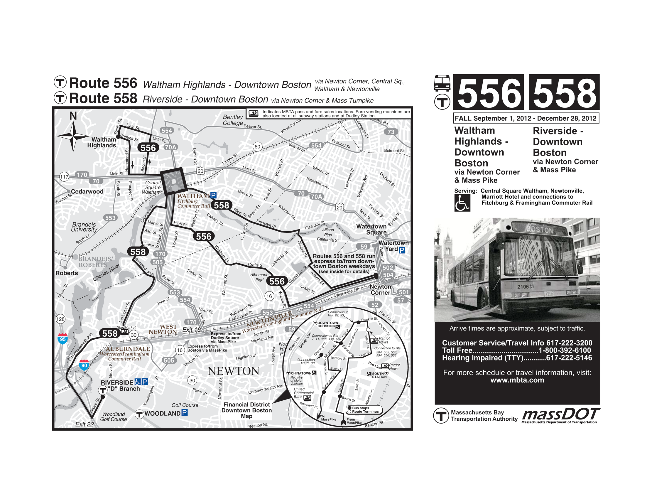
Riverside Station is the western terminus of the MBTA’s Green Line D Branch light rail line. Service at Riverside Station began in 1959. Riverside Station is bordered by Interstate 95 (I-95)/Route 128 to the west and by the Massachusetts Turnpike (I-90) to the north, with respective access ramps less than one mile away. The Framingham/Worcester commuter rail line is located to the north of Riverside Station, approximately three-quarters of a mile away. Bus Route 558 connects Riverside Station to downtown Boston via Newton Corner and I-90. On an average weekday, there are 46 passengers boarding Route 558 at Riverside Station for inbound service and 39 for outbound service. A map of Route 558 is provided in the appendix.
Within the vicinity of Riverside Station, Hotel Indigo is located directly to the southwest, the Woodland Country Club is located directly to the southeast; other nearby destinations include several golf courses, two office parks, Williams Elementary School, and Lasell College. The surrounding area is primarily a residential neighborhood. The Auburndale Village Center lies approximately two miles to the north of Riverside Station, on the north side of I-90.
On February 12, 2009, the MBTA authorized an 85-year lease for a development project at Riverside Station called “The Station at Riverside,” which is proposed to be a mixed-use, transit-oriented development on a portion of the Riverside MBTA parcel. It would consist of 426,400 gross square feet of office space, 295 residential apartment units, and 19,300 square feet of ancillary retail space.
The project would provide approximately 2,003 parking spaces in structured parking facilities, which would be available for both project site uses and MBTA needs. Pedestrian pathways are proposed to be built throughout the project site, as well as bike lanes along Grove Street. The project is currently undergoing the permitting process with the City of Newton. The results of this study will aid the City of Newton in defining a new plan for Riverside Station that improves safety for bicyclists and pedestrians.
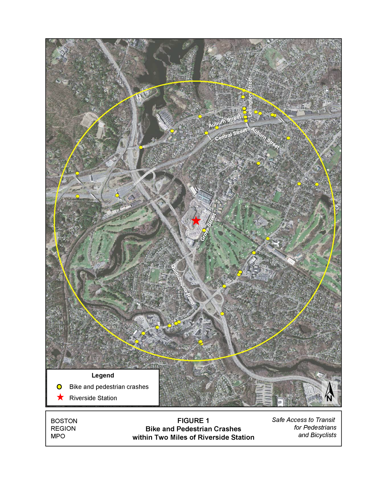
Records available to Boston Region MPO staff show that there are four intersections within two miles of Riverside Station that each experienced three or more pedestrian or bicycle crashes from 2005 to 2009 (see Table 1).3 Figure 1 illustrates the locations of the bicycle and pedestrian crashes in proximity to Riverside Station. The majority of the bicycle and pedestrian crashes occurred along Washington Street, Commonwealth Avenue, and Lexington Street. It was assumed that the purpose of the majority of bicycle and pedestrian travel along Washington Street would be to access the MBTA Woodland Station, rather than Riverside Station for inbound service, since Woodland Station is closer to Boston. Therefore Washington Street was excluded from the study area of this analysis. Commonwealth Avenue was also excluded, since it is separated from Riverside Station by I-90. The intersection of Auburn Street at Lexington Street was included because it links the residential neighborhood to the urban, commercial area.
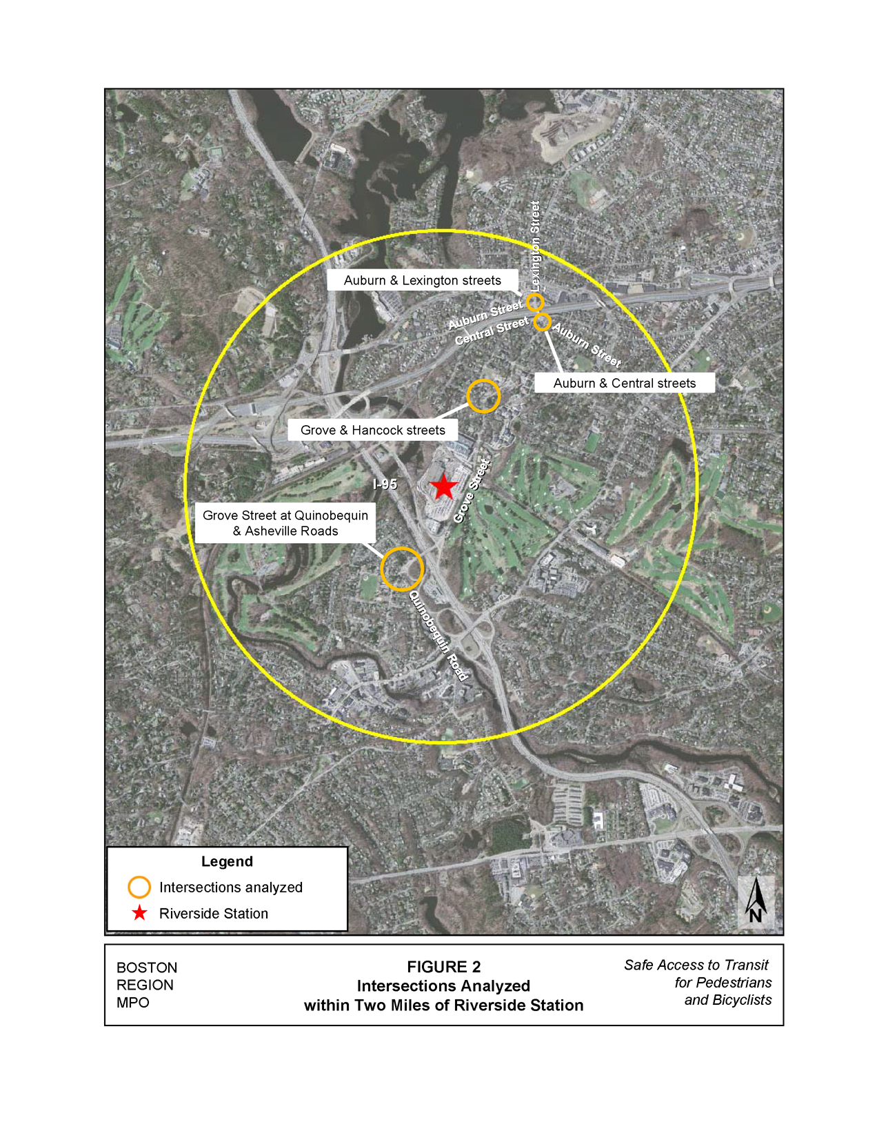
Given that access to Riverside Station is limited by the adjacent highways and land uses, such as I-90, I-95, and the bordering country club, this analysis focused on the Grove Street corridor, from Quinobequin Road to Auburn Street, in addition to the intersection of Auburn and Lexington streets. The intersections located along Grove Street and Auburn Street that were selected for further analysis (Figure 2) are:
Table 1
Intersections within Two Miles of Riverside Station with Three
or More Pedestrian or Bicycle Crashes from 2005 to 2009
Intersection |
City/Town |
Vehicle Crashes |
Pedestrian Crashes |
Bicycle Crashes |
Total Crashes |
Glen Road/Washington Court/Washington Street |
Wellesley |
50 |
1 |
2 |
53 |
Cedar Street/River Street/Walnut Street |
Wellesley |
26 |
1 |
3 |
30 |
Commonwealth Avenue/Lexington Street |
Newton |
68 |
4 |
2 |
74 |
Auburn Street/Commonwealth Avenue (south of I-90) |
Newton |
34 |
2 |
2 |
38 |
In February 2012, a traffic impact and access study was conducted for The Station at Riverside project as part of its permitting requirements.4 The study analyzed Grove Street and proposed the following recommendations for operational and safety improvements:
MPO staff concurs with the Metropolitan Area Planning Council’s comments on bicycle and pedestrian uses that were provided to the Massachusetts Department of Transportation on August 19, 2011 (see Appendix). This project should provide separate bicycle facilities within the project site and along Grove Street, with seamless connections between both. The bicycle facilities provided along Grove Street should be continuous throughout the Lower Falls and Auburndale neighborhoods.
As for the proposed roundabout at Grove Street and the Route 128 NB ramps, more information would be needed regarding Options A and B-2 level of service (LOS) analyses for the right turns from the Route 128 NB off-ramp onto Grove Street. According to the traffic impact study, the proposed roundabout would improve these right turns from a LOS F to a LOS B or better. The turn bay for the right turns on Route 128 NB off-ramp appears to add storage room for vehicle queue; however, the merge point of the right turns on Route 128 NB off-ramp and Grove Street EB traffic is so close to the roundabout that this design prevents the turn bay from operating as a right-turn slip-lane. Therefore a clarification of how the Route 128 NB off-ramp right turns were treated in the roundabout analysis for Options A and B-2 and for the 2022 Build conditions without mitigation would be needed.
Additionally, if a roundabout at Grove Street and Route 128 NB ramps is included as part of The Station at Riverside project, it should be designed with single lanes, splitter islands, and, if possible, with bike lanes along the outer perimeter of the roundabout. Due to potential visibility issues, the pedestrian crossing on the west leg should be clearly marked with a pedestrian warning sign (MUTCD W11-2) at the crosswalk, as well as a pedestrian warning sign combined with an “ahead” sign (MUTCD W16-9P) in advance of the crosswalk. A new crosswalk should be provided on the north leg of Grove Street and Deforest Road in order to accommodate potential crossings at the sidewalk terminus on the east side of this intersection. A curb-cut ramp to the sidewalk on the east side of Grove Street in advance of the roundabout should also be provided in order to accommodate bicyclists wishing to transition from the bike lanes on the bridge to the sidewalk when traveling through the roundabout.
The proposed roundabout at Grove Street and Route 128 SB ramps/Asheville Road appears to be warranted, based on a review of the analyses provided in the traffic impact study. It should also be designed with single lanes, splitter islands, and, if possible, with bike lanes along the outer perimeter of the roundabout.
The Station at Riverside project is currently undergoing the City of Newton special permit process and the Executive Office of Energy and Environmental Affairs Massachusetts Environmental Policy Act permitting process. There are short and long-term improvements that can be implemented independent of The Station at Riverside project in order to improve safety for the various ROW users along Grove Street, and they are provided in the subsequent sections.
 Grove Street Corridor
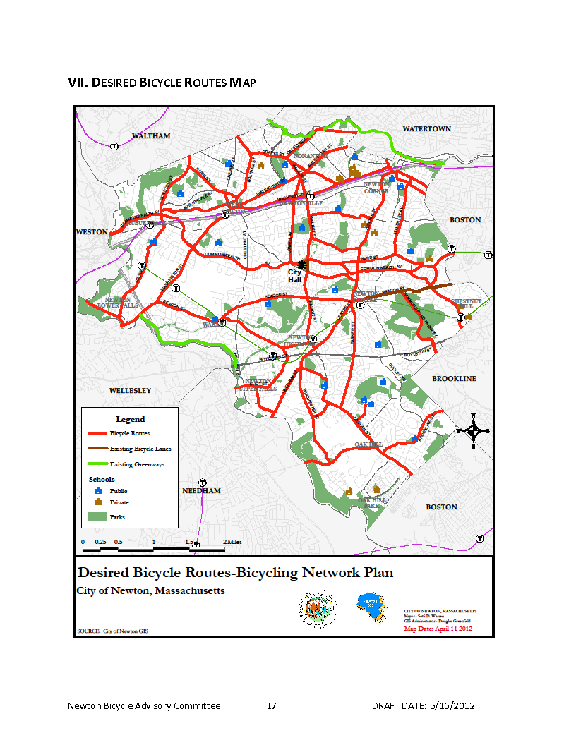
Grove Street, which is under the jurisdiction of the City of Newton, is classified as an urban collector roadway, with an average daily traffic volume of approximately 15,500 vehicles.5 The posted speed limit along Grove Street is either 25 miles per hour (mph) or 30 mph. The City of Newton has identified the section of Grove Street from Auburn Street in Auburndale to Hagar Street in Lower Falls as a desired bicycle route.6
The Grove Street corridor provides the sole connection to Riverside Station for bicyclists and pedestrians traveling from the residential neighborhoods of Lower Falls and Auburndale. It also serves as the main link to office parks located near Riverside Station, Williams School, Echo Falls Preschool, and Lasell College, as well as to the Auburndale Village Center north of the Auburn Street bridge and the Auburndale commuter rail station.
The majority of the roadway segment pavement is approximately 27 feet wide, with two travel lanes and 5-foot-wide sidewalks in good condition, and is well shaded by trees. Most of the intersections in the study area have pedestrian treatments, such as crosswalks and pedestrian curb-cut ramps. There are also some intersections with enhanced pedestrian treatments, such as pedestrian signals with a dedicated pedestrian phase or audible push buttons, pedestrian refuge islands, crosswalks with either colored brick pavers or ladder-style markings, and “State Law – Yield to Pedestrians” signs. Further south of the study area, traffic calming improvements were implemented at the intersection of Grove Street and Cornell Street in the form of a raised intersection with red crosswalks on all approaches and a textured brick paver center.
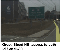 During the site visit, some conditions were observed that may affect bicycle and pedestrian access to Riverside Station. There are several crosswalks along the corridor that are simple parallel line markings, rather than ladder-style crosswalks, which are more visible to motorists. There are gaps in the sidewalk along the east side of Grove Street between the rail corridor overpass and the access ramp to I-95 northbound. The pedestrian entrance into Riverside Station had no signage to encourage its use. There was excessive dirt along the sidewalk and in the roadway on the west side of Grove Street near the pedestrian entrance to Riverside Station. Vegetation along the west side of Grove Street between the access road to the on-ramp to I-90 and to I-95 northbound and the bridge, as well as along the east side of Grove Street near its intersection with Hancock Street, were overgrown and either impeding pedestrian access or impairing visibility between motorists, pedestrians, and bicyclists. There are no bicycle features along Grove Street.
Short-term recommendations include the following:
Pedestrian Improvements 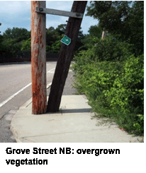
Bicycle Improvements
The following long-term measures are recommended to improve safety for the various ROW users along Grove Street:
Pedestrian and Bicycle Improvements
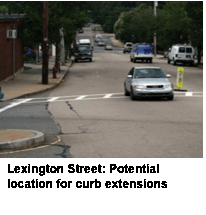
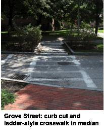 Stripe a ladder-style crosswalk on the north leg of Grove Street at the southern entrance to the Tech Target office complex. This would require a curb cut through the existing median, similar to the crosswalk on the north leg of Grove Street at the northern entrance to the Tech Target office complex (see picture at right). This crosswalk will serve pedestrians traveling along the east side of Grove Street who wish to access Riverside Station, and it would help to facilitate crossing Grove Street prior to the sidewalk terminus.
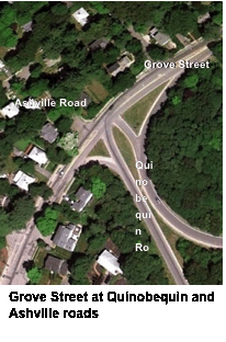 Grove Street at Quinobequin Road and Asheville Road
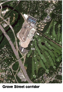
The intersection of Grove Street and Quinobequin and Asheville roads is approximately one-third of a mile southwest of the entrance to Riverside Station. Since I-95/Route 128 generally runs in a north-south direction on the southwestern border of the Riverside Station property, the only route between the Lower Falls neighborhood and Riverside Station is along Grove Street via a two-lane bridge. The intersection of Grove Street at Quinobequin and Asheville roads is located west of this bridge, with access ramps to I-95/Route 128 in close proximity. The intersection is unsignalized, and moderate traffic volumes and speeds were observed during the site visit.
Quinobequin Road serves as both an access road to I-95/Route 128 and an access road to Route 16. The northbound approach along Grove Street at this intersection provides an uncontrolled, continuous right turn onto Quinobequin Road. This does not create a conflict for pedestrians, since the northbound sidewalk on the east side of Grove Street terminates as it approaches this intersection. However, there is no crosswalk across Grove Street for pedestrians, who must cross at the termination of the sidewalk. Additionally, the uncontrolled, continuous right turn may create conflicts for bicyclists traveling along Grove Street to Riverside Station. The Station at Riverside project proposes to construct a modern roundabout at this intersection, which, if designed properly, would help alleviate conflict points between motorists and bicyclists. The roundabout would also include a crosswalk on the south leg of the intersection, which would allow pedestrians to safely cross Grove Street prior to the termination of the sidewalk. There is no crosswalk on the east leg of this intersection, across Asheville Road.
The following short-term recommendations would improve safety for the various ROW users at this intersection:
Pedestrian Improvements:
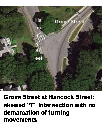 Grove Street at Hancock Street
The intersection of Grove Street at Hancock Street is approximately 1,500 feet from the northeast side of Riverside Station. It is an unsignalized, skewed, “T” intersection. There are two travel lanes with a discontinuous median that serves as channelizing islands along Grove Street. There are no pavement markings at this intersection. Grove Street curves as it approaches this intersection, which may limit motorists’ visibility of bicyclists traveling northbound close to the curve.
Hancock Street has a stop sign, stop bar, and crosswalk for the southeast approach to Grove Street. The pedestrian curb-cut ramps do not have detectable warning pads. There are no crosswalks on Grove Street; however, there may be a low demand for crosswalks, since Riverside Station is on the same side of Grove Street that intersects with Hancock Street, which has a crosswalk. During the site visit, low traffic volumes and speeds were observed along both Grove and Hancock streets.
The following short-term measures are recommended to improve safety for the various ROW users at this intersection:
 Stripe pavement markings to more clearly demarcate vehicle travel through the intersection.
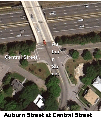
The intersection of Auburn Street at Central Street lies at the northern terminus of Grove Street, which is the northern border of the residential neighborhood located between Riverside Station and I-90. The north approach of Auburn Street crosses I-90 via a bridge and enters a commercial area. There is also an entrance to the Auburndale commuter rail station on this bridge. The north side of Central Street west of this intersection is lined with parked cars that appear to be for users of the Auburndale commuter rail station. Auburn Street is comprised of two travel lanes that are approximately 20 feet in width, which would allow sufficient space for signed and striped bike lanes in both directions.
All legs of this intersection have crosswalks with simple, parallel lines. All corners of this intersection have pedestrian curb-cut ramps, although they do not have detectable warning pads. All corners of this intersection also have pedestrian signals, where push buttons activate an exclusive pedestrian phase for all legs of the intersection at the same time. The north leg of this intersection has a crossing distance of 73 feet and the pedestrian signal timing is 17 seconds. Based on a walking speed of 3.5 seconds per foot, the minimum pedestrian signal timing for a crossing distance of 73 feet is 21 seconds.7 All legs of this intersection have crosswalks marked with parallel lines. The sidewalks are in fair condition.
The following short-term measures are recommended to improve safety for the various ROW users at this intersection:
 Auburn Street at Lexington Street
The intersection of Auburn Street and Lexington Street is located on the north side of the Auburn Street bridge that crosses I-90. Lexington Street runs in a north-south direction and is classified as an urban collector between Commonwealth Avenue and Auburn Street. It meets Auburn Street at an unsignalized “T” intersection. The eastbound approach along Auburn Street is stop-controlled.
The north and west legs of this intersection have crosswalks and “State Law – Yield to Pedestrians” signs. The west leg has a pedestrian crossing distance of approximately 70 feet, which is broken up by a pedestrian refuge island. The pedestrian crossing distance of the north leg is approximately 50 feet. The northwest corner radius at this intersection appears to be wide, which increases the pedestrian crossing distance and may increase the speed of turning vehicles. During the site visit, traffic volumes and speeds appeared to be moderate at this intersection. Between 2005 and 2009, there were four pedestrian crashes and two bicycle crashes reported along Lexington Street in close proximity to this intersection. There are no bicycle-specific features at this intersection.
 The following short-term recommendations would improve safety for the various ROW users at this intersection:
Pedestrian Improvements:
The following long-term measures are recommended to improve safety for the various ROW users at this intersection:
Pedestrian Improvements:
The recommendations of this study aim to promote accessibility to the Riverside Station from surrounding neighborhoods for pedestrians and bicyclists. If implemented, these recommendations would provide pedestrians and bicyclists with safer and more convenient paths to Riverside Station.
The recommendations are either short-term, low-cost, and quick to implement, or are long-term and would require a more intensive capital investment with a longer implementation schedule. Short-term improvements recommended in this study include striping pavement markings and crosswalks, installing pedestrian and bicycle signage, installing ADA-compliant improvements, striping bike lanes and/or shared-lane markings, trimming vegetation, and providing well-maintained roadways. These types of improvements would improve visibility between pedestrians, bicyclists, and motorists, indicate where these users should travel within the ROW, and provide a safer and more convenient environment.
Long-term improvements recommended in this study include constructing curb extensions, striping new crosswalks—which may require constructing curb cuts, constructing a more prominent pedestrian and bicycle entrance into Riverside Station, and ensuring adequate lighting. These types of improvements more effectively increase visibility between pedestrians, bicyclists, and motorists, as well as helping to reduce vehicle speeds and minimizing crossing distances for pedestrians. The enhanced bicycle and pedestrian entrance at Riverside Station would provide a more direct route to the station platform, while also reducing interaction with vehicles at the main vehicle entrance.
Providing bicycle facilities along Grove Street, as proposed in the City of Newton’s Bicycle Network Plan, would connect Riverside Station to the Lower Falls and Auburndale residential neighborhoods.8 It is recommended that during future roadway reconstruction and/or development projects, such as The Station at Riverside project, the City of Newton evaluate ROW widths in order to determine if segregated bicycle facilities, such as cycle tracks, shared-use paths, and buffered bike lanes, can be accommodated along Grove Street. These types of bike facilities would provide a safer environment for bicyclists.
Implementing the recommendations in this study will improve the roadways used by pedestrians and bicyclists accessing Riverside Station. This may encourage more users of Riverside Station to choose bicycling and walking as modes of transportation, and may also promote the use of public transit. This, in turn, may shift users from personal vehicles, which may also help reduce the strain on commuter parking at Riverside Station, which has a 90% utilization rate. Reducing the demand for parking at Riverside Station is a more cost-effective solution in comparison to constructing additional parking spaces. Overall, through the implementation of these recommendations, the City of Newton will improve access to safe, healthy, efficient, and varied transportation options for its residents and visitors.
MSA/CB/cb
1 Boston Region Metropolitan Planning Organization (MPO), Needs Assessment (Volume 2 of Paths to a Sustainable Region), Central Transportation Planning Staff (CTPS), September 27, 2011.
2 Boston Region MPO, MBTA Systemwide Passenger Survey, CTPS, May 19, 2010.
3 MassDOT Registry of Motor Vehicles Division crash data, 2005 to 2009.
4 VHB/Vanasse Hangen Brustlin Inc., “Traffic Impact and Access Study: Riverside MBTA Station Redevelopment,” BH Normandy Riverside LLC, February 2012.
5 Boston Region Metropolitan Planning Organization, “Average Daily Traffic on Massachusetts Roads,” prepared by the Central Transportation Planning Staff, 2008.
6 City of Newton, “Bicycle Network Plan”, Newton Bicycle Advisory Committee, August 12, 2012.
7 Massachusetts Highway Department. Project Development and Design Guide, Massachusetts Department of Transportation, January 2006.
8 City of Newton, Bicycle Network Plan, Newton Bicycle Advisory Committee, August 12, 2012.
Riverside Station Service History
MBTA Bus Route 558
Newton Bike Route Map
MAPC’s Comments on the Station at Riverside DEIR to City of Newton
The opening of the Riverside transit line in 1959 represented an important milestone in Boston’s post–World War II transportation development. Financial losses during the Great Depression and the ridership demands of war mobilization stressed and depleted Boston’s transportation system. As the war ended, plans were drawn up to modernize the system, including service in the central subway, the oldest subway service in America.
An extensive network of streetcar lines served Boston and nearby communities, several of which continued underground in the central subway. The overall plan was to replace streetcar operations in street traffic with rubber-tired buses and trackless trolleys, and concentrate on routes utilizing the central subway. Furthermore, routes that used the central subway but required lengthy on-street running were gradually discontinued.
While streetcars’ use of streets was being eliminated, a new transit line was being implemented that, for the first time, would be totally grade-separated. Today’s Riverside Line had been the little-used New York Central “Highland Branch” commuter rail line. The Metropolitan Transit Authority (the predecessor of the MBTA) purchased the line from the railroad, built a connection to Kenmore Station, added electric catenary (overhead electric lines), and in 1959 began frequent service on what was then called the Highland Branch. Within a decade the line was re-branded as the Riverside branch of the Green Line, also called the D Line.
General Recommendations
Overall, none of the study locations have issues that seriously impede the access of pedestrians and bicyclists to a transit station. However, general maintenance issues should be addressed in all of the study areas. In addition, conditions and facilities could be further improved in order to enhance the safety and quality of pedestrian or bicyclist access; best-practices guidelines should be consulted and applied when possible.
Maintenance of Existing Facilities and Amenities
In each of the study areas, many of the existing facilities and amenities are in need of repair or upkeep. Faded crosswalk paint, uneven and broken pavement surfaces on sidewalks and roadways, malfunctioning pedestrian signals, and malfunctioning streetlamps are examples of facilities and amenities that are in need of attention. At a minimum, these should be in good, functional condition.
Seasonal Maintenance
Another condition commonly found at many study locations is a need for regular and seasonal upkeep of sidewalks and roadways. Dirt, sand, and debris accumulate in the gutters of roads and on sidewalks, particularly during and after the winter season. The winter also presents the issue of snow and ice, which are often piled onto sidewalks and along the sides of roads. In the summer, weeds and overgrown plants can obstruct pedestrian and bicyclist movement. Aside from being unpleasant and a nuisance, these conditions create obstructions that may make travel hazardous and impede transit patrons from easily using the MBTA system.
Sidewalks
It is important to provide a continuous and accessible network of sidewalks along walking routes to MBTA stations, particularly for pedestrians with disabilities. When a sidewalk is provided on only one side of a roadway, pedestrians often walk in the street or cross at unmarked midblock locations. Sidewalk surfaces should be level, smooth, and without obstructions in the pathway of pedestrians. In addition, best-practices guidelines recommend a buffer between the sidewalk and the roadway. However, on most of the streets in the study areas, roadway widths may not permit this feature.
In a few locations, the sidewalks do not have a curb-cut wheelchair ramp at crosswalks. Also at some locations, sidewalks have diagonal (apex) curb ramps, where only one ramp is provided at a street corner; these ramps typically are not aligned with the marked crosswalks. Diagonal curb ramps are the predominant type used in the study areas; however, this type of curb ramp is not recommended by current Federal Highway Administration best-practices guidelines. Instead, street corners should have two curb ramps, one aligned with one street’s crosswalk and the other aligned with the other street’s crosswalk (see the diagram at the left). For additional safety, the bottom of the ramps should have a detectable warming strip.
 Crosswalks
The crosswalks in the study areas generally are striped with basic markings, very few of which are marked in a manner that goes above and beyond the Manual on Uniform Traffic Control Devices (MUTCD) standards. Typically, they are striped with two parallel solid white lines or have a ladder-style marking. In most cases, the stop line for vehicle traffic is too close to the crosswalk.
Best-practices guidelines recommend that crosswalks be well marked and accentuated by curb extensions. This study recommends, at a minimum, marking sidewalks with ladder-style striping. A 10-foot distance between the stop lines and crosswalks is recommended. Treatments for multilane roadways should include a 10-to-30-foot distance between the stop line and the crosswalk, pedestrian refuge islands/medians, and curb extensions for increased visibility of pedestrians. Also, this study recommends appropriate signs to warn motorists of pedestrian crossing activity.

Signalized Pedestrian Crosswalks
 Some signalized pedestrian crossings in the study area have malfunctioning signals and buttons. As a first step, all existing signals should have functioning buttons and walk signals. Moreover, the crossings should be enhanced with more modern signal technology. For example, signals should be equipped with pedestrian activation buttons that light up when pushed, as an indication of having been successfully activated. Also, countdown-style pedestrian crossing signals (see photo, at left) should be used in places with a sufficient amount of pedestrian activity to warrant them.
Intersection Safety
 Several intersections in the study areas should be made safer for pedestrians and bicyclists through some minor redesign. (An example of a possible redesign is shown in a photo below, from the website www.pedbikeimages.org/DanBurden.) Curb extensions at the corners, for instance, create a tighter turning radius for vehicles, which slows the speed of traffic at turns. Curb extensions also provide better sight lines for motorists to watch for pedestrians and vice versa. Furthermore, medians and islands can be enlarged to better guide and control traffic, often slowing vehicle speeds as well. Medians and traffic islands should be large and visible enough to provide sufficient refuge for pedestrians. Plus, striping should be clear and delineate the vehicle turning lanes, the crosswalks, and the stop lines. Lastly, intersections with significant pedestrian activity could be marked as a pedestrian crossing zone (instead of having only crosswalks), where an all-red pedestrian phase is part of the signal cycle.
On-Street Bicycling
On many roads that lead to transit stations, bicyclists must contend with high traffic volumes and on-street parking. High traffic volumes, particularly when combined with high speeds and frequent turning movements, can be intimidating to bicyclists. Traffic-calming measures that reduce vehicle speeds can be implemented to help reduce both the severity and incidence of motor vehicle crashes with bicycles, and can also make bicyclists feel more comfortable while riding along roadways. On-street parking poses challenges in the form of conflicts between vehicles that are parking or discharging passengers, and bicyclists, who are often negotiating traffic to their left in addition to coping with the parked-vehicle activity to their right.
Roadway design and condition are also issues for bicyclists. Narrow lanes and narrow shoulders are a concern, particularly on roads with high traffic volumes. Potholes and poor pavement should be fixed, as bicyclists are more sensitive to pavement conditions than are motorists. Storm-sewer grates should be either grids or parallel bars appropriately placed perpendicular to traffic flow.
There are different types of on-street bicycle facilities that can be provided to improve safety for bicyclists, such as cycle tracks, buffered bike lanes, bike lanes, shared lanes, paved shoulders, and signed routes. Further study of the availability of right-of-way, roadway conditions and bicycle traffic volumes should be conducted in order to determine the type of on-street bicycle facility that would be appropriate for a specific roadway.
Bicycle Parking
All of the stations studied provide bicycle racks. When selecting locations for the installation of bicycle racks, it is important to consider visibility, lighting conditions, protection from the elements, and proximity to destinations. Additionally, racks should be situated in spots that offer enough space not only for storing bicycles, but also for maneuvering them. If bicycle racks or cages are located in an area not easily seen by bicyclists, then directional signage should be considered.
Current bicycle parking guidelines9 recommend that providers of bicycle racks select types that:
 Common styles of bicycle parking racks that meet the above guidelines include: the inverted-U or hoop (see photo to left), “A” (a hoop with a horizontal bar), and post-and-loop (also known as bike hitch). Many manufacturers produce these or acceptable variations of these styles. These rack elements are typically arranged in a row or array; the spacing between the rack elements should be a minimum of 30 inches (on centers), but preferably a more comfortable 36 to 42 inches.
Signs: Wayfinding for Transit Stations
Well-placed wayfinding signs—pointing the way to a transit station—reach out to potential riders. They are similar in function to signs that direct motorists to highway ramps. Care should be taken to install the signs at a height and orientation favorable to pedestrians. Also, these signs should use conventional MBTA symbols, lettering, and colors.
Travel Environment
The aesthetic look and feel of the travel environment can encourage use by pedestrians and bicyclists. Communities should implement measures to improve the quality of the street environment through the use of landscaping (trees, shrubs, and flowers, all appropriately placed), lighting, furniture (such as benches and trashcans), and artwork (such as sculptures and murals). Chambers of commerce and business owners should also be encouraged to enhance storefronts and streetscapes.
Future Considerations
The opportunity to implement many of the recommended improvements may only arise when a roadway construction project occurs. Any roadway construction project should apply best-practices guidelines for serving pedestrian and bicyclist travel in general. More specifically, projects should improve walk and bike access to transit stops and stations as much as possible. In essence, the MBTA, the MassDOT Highway Division, local governments, and land developers should coordinate and cooperate on all transportation improvement projects to ensure that pedestrian and bicyclist needs are integrated into the final designs.
When improvements are made to the accessibility of transit for pedestrians and bicyclists, they can be highlighted in public information campaigns promoting the option of bicycling to transit stations. The improved accessibility can be extolled, along with the cost, time, and health benefits to individuals.
9 One reference is Bicycle Parking Guidelines (2002), adopted by the Association of Pedestrian and Bicycle Professionals. For more information, please refer to www.bicyclinginfo.org/de/parkguide.htm.